
History & Heritage
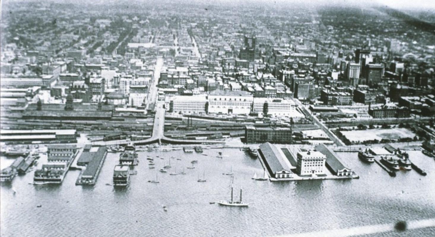
Like most major cities, Toronto is located beside a major body of water. Throughout history, cities have been founded at the intersections of transportation routes, or at points where goods needed to shift from one mode of transportation to another. For centuries, oceans, lakes, and rivers have provided an important means of transport.
Toronto’s location on Lake Ontario, the first Great Lake from the St. Lawrence River, has been instrumental over the course of the city’s history. Long before Europeans came to the area, Toronto was home to Indigenous Peoples who used this location as the start of a shortcut from the lower to upper Great Lakes.
Related Documents
Read the 2008 Archaeological Conservation and Management Strategy [PDF]
View the 2008 Public Meeting Presentation [PDF]
Land Acknowledgement
Waterfront Toronto acknowledges that the land upon which we are undertaking our revitalization efforts is part of the traditional territory of many nations including the Mississaugas of the Credit, the Anishnabeg, the Chippewa, the Haudenosaunee and the Wendat peoples and is now home to diverse First Nations, Inuit and Métis peoples. We also acknowledge that Toronto is covered by Treaty 13 with the Mississaugas of the Credit.
While the French knew about the Toronto passage from the early 1600s and had occasionally set up trading camps along it, it was not until the 1720s that they maintained a permanent presence in Toronto. In 1720, the French built a small trading post on the Humber River on the south end of the passage. In 1750, they began building Fort Rouille, a modest trading post on the Lake Ontario shoreline, just east of the Humber.
After the American Revolution, Toronto gained importance as a site to expand the fur trade and as a settlement. The British, concerned about threats from the United States, decided that Toronto would be an ideal site for a naval base. Governor John James Simcoe believed the area’s defensible harbour would allow his forces to control Lake Ontario, and the Toronto passage would enable the movement of supplies and troops to the upper lakes if the Americans gained control of Lake Erie. The construction on Fort York started in 1793 and is now considered the birth of urban Toronto.
Since much of the city’s major trade has historically been by boat, having manufacturing facilities adjacent to the waterfront made good business sense. Factories on the lakeshore allowed supplies to be easily received and finished products to be effectively transported. However, by the 1830s and ‘40s, the lack of available land along the waterfront severely limited the growth of the shipping and industrial and railway infrastructure.
In the 1850s, a massive campaign of lake-filling was undertaken to expand the shore land south to the Esplanade. For the next hundred years, the shore was extended farther and farther south. The original shoreline was north of today’s rail corridor, and Front Street was built along the edge of the shoreline. The filling continued until the 1950s when the modern shoreline was achieved.
Early 1900s
After the Second World War, Toronto’s relationship with its waterfront changed. With industry concentrated along the waterfront, the downtown core became undesirable as a place to live. For decades, the wealthy moved from the industrial urban areas to the cleaner suburbs.
As cars became more accessible to more people, Toronto residents moved out of the downtown core to the outlying areas. However, since many of the jobs were still in downtown industrial areas, major roads and highways were needed to enable people to commute.
At the time, highways were built as rings around cities. For most cities located beside water, a portion of that ring was built on or near the waterfront. Toronto was no different, and in the 1950s the Gardiner Expressway was built, effectively cutting the people off from the lake.
In the 1970s, a sort of Urban Revolution was changing the world, and cities started to rediscover their waterfronts. Major cities around the world not only redeveloped their waterfronts, they used their regeneration projects to catapult themselves onto the world stage. Their newly developed waterfronts attracted more residents, more employers, more jobs and more visitors.
Toronto is one of the last major waterfront cities to redevelop its waterfront. Over the years, there have been many ideas about what to do with Toronto’s waterfront but a cohesive vision was missing. Harbourfront Centre, Queens Quay Terminal, and the surrounding area are the result of one effort to redevelop the Central Waterfront in the early 1970s.
Formation of Waterfront Toronto
In 1999, Prime Minister Jean Chrétien, Premier Mike Harris and Mayor Mel Lastman announced the formation of a task force to develop a business plan and make recommendations for developing the waterfront as part of Toronto’s bid to host the 2008 Summer Olympics.
Chaired by businessman Robert Fung, the task force determined that waterfront revitalization was necessary, that it was “an almost unprecedented development opportunity” and would have “a major, positive economic impact on the City, the region and the country.”
The task force said that the revitalization was not merely a public megaproject but rather “an integrated partial solution to the environmental, transportation, infrastructure, housing, economic and tourism challenges confronting the City.”
The task force also stated that the need and business case for the redevelopment of Toronto’s waterfront was so strong that irrespective of the Olympic bid waterfront renewal should happen.
After the 2008 Olympics were awarded to Beijing, the three orders of government pledged their support to the revitalization of Toronto’s lakefront.
In November 2001, the three levels of government established Waterfront Toronto (then known as the Toronto Waterfront Revitalization Corporation) to oversee all aspects of the planning and development of Toronto’s central waterfront.
The corporation’s Board of Directors began meeting in February 2002. In March, a small group of core staff was hired and an office set up. In April, the corporation hired a program manager, the Toronto Waterfront Joint Venture, to oversee implementation of waterfront projects. In December 2002, the government of Ontario passed the Toronto Waterfront Revitalization Corporation Act, the legislation which gives the corporation permanent status.
In May 2003, the provincial government enacted the Toronto Waterfront Revitalization Corporation Act, creating a permanent independent organization to oversee and lead the renewal of Toronto’s waterfront.
Read the Toronto Waterfront Revitalization Corporation Act, 2002 [PDF].
Video: 20 Years of Placemaking
Below is a short video conversation we had with Bob Fung, our founding Chair about the formation of Waterfront Toronto. Watch the video to learn more [LINK}.
Archaeological Conservation
Waterfront Toronto, together with the City of Toronto, developed a comprehensive Archaeological Conservation and Management Strategy (ACMS). The strategy is designed to protect and interpret the archaeological record of the waterfront, and also to develop policies and protocols to manage these archaeological resources in advance of the major construction required for revitalization.
Developed with the support of stakeholders and members of the general public, the ACMS has helped establish innovative policies for both Waterfront Toronto and the City of Toronto. Besides identifying areas where potential archaeological resources are likely to be found, it has also highlighted the importance of celebrating cultural heritage and interpreting the past including, the evolution of the shoreline, Aboriginal occupations, as well shipping, the railway, and the industrialization of the waterfront.
Waterfront Toronto retained Archaeological Services Inc. to prepare the ACMS that serves to:
- Inform the planning and development process and address issues pertaining to the preservation and documentation of archaeological resources;
- Establish a framework for the evaluation of significant archaeological resources;
- Identify opportunities, constraints and best practices for the preservation, interpretation, commemoration and exhibition of these archaeological resources;
- And Explore opportunities for bringing new archaeological interpretive concepts to an area undergoing ongoing revitalization.
To learn more about archaeology in Toronto, visit City of Toronto Archaeology [LINK] . View the 2008 Public Meeting Presentation [PDF].
History of Toronto’s Waterfront Precincts
Central Waterfront
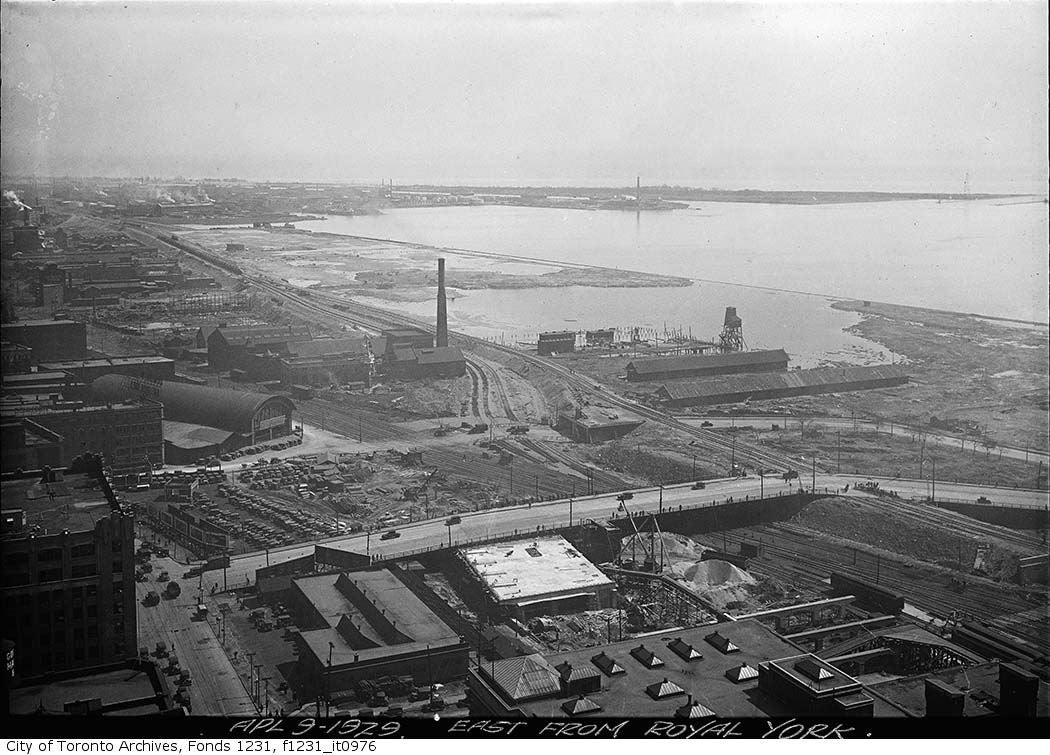
In the heyday of marine shipping, the waterfront was bustling with commercial activity and the growing demand for facilities led to extensive land filling. Two hundred years ago the natural shoreline of Lake Ontario was at Front Street, and all of today’s central waterfront area was created by decades of lake infilling.
With the subsequent decline of shipping and the rise of truck transportation, these large waterfront areas became less useful for industrial purposes, and new visions for their use were needed.
Many efforts have been made over the past hundred years to plan the central waterfront. Learn more about the history of the central waterfront .
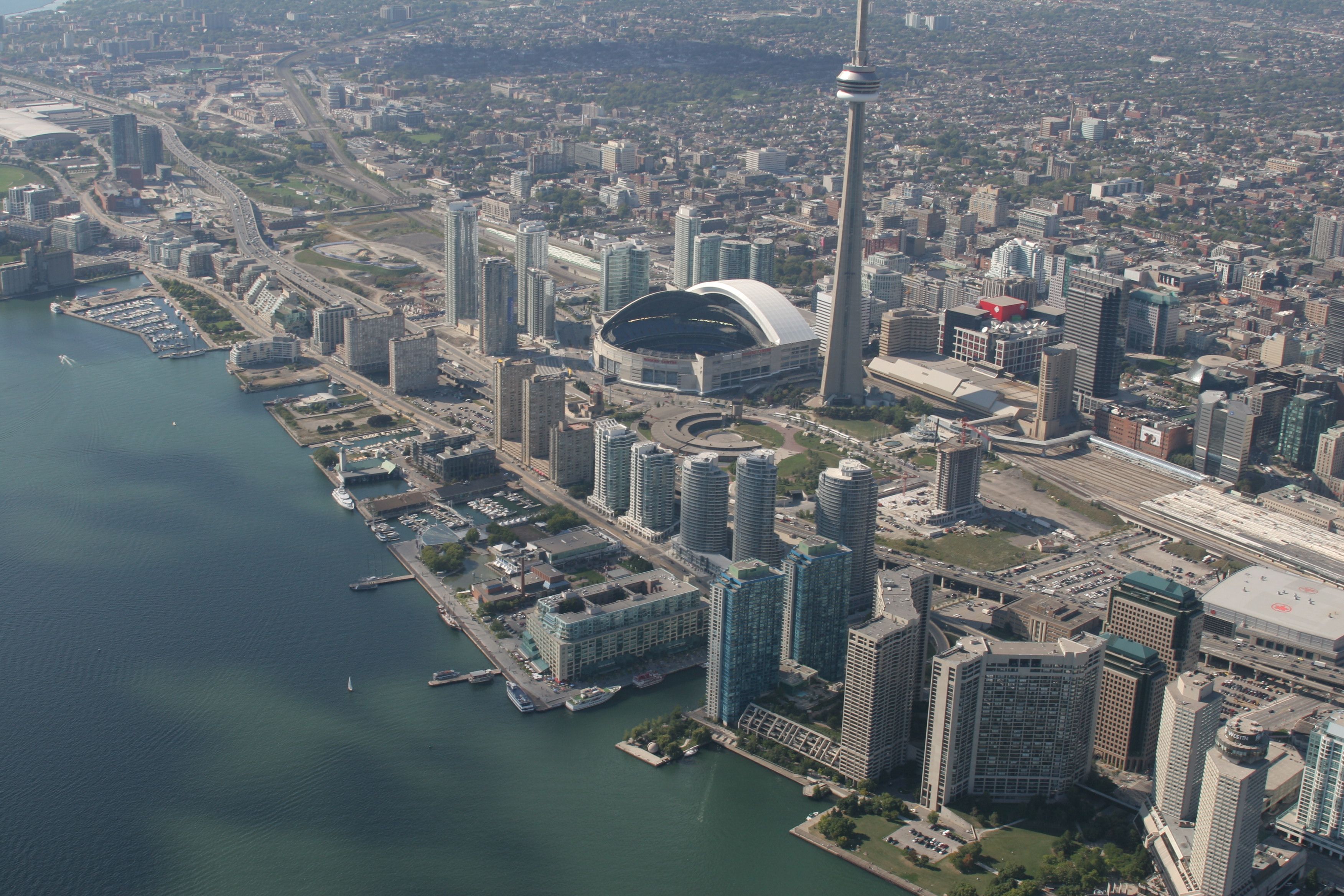
The Port Lands – a 356 hectare (880 acre) area east of the city’s downtown between the Inner Harbour and Leslie Street, south of Lake Shore Boulevard – are located on what was once the largest natural wetland on the Great Lakes.
The Ashbridges Bay Marsh was created by the lower Don River as it emptied into Toronto’s inner harbour. The landscape in the area was dramatically altered in the late 19th and early 20th centuries. The Don River and the marsh it created posed many problems for the adjacent settlement of York and starting in 1870 a series of breakwaters, channels and other man-made structures were created to manage the area. Most failed or caused additional problems and in the 1910s plans were developed to change the area permanently.
In 1912, the Board of the Toronto Harbour Commission completed a plan for transforming Ashbridges Bay Marsh into a massive new industrial district with waterfront parks and summer homes. The mouth of the Don River was redirected into the concrete-lined Keating Channel in 1914 and infilling of the surrounding wetlands began. By 1922, more than 200-hectares (500-acres) of land had been created on the former marsh, with another 200-hectares soon to follow. These lands were quickly occupied by industry and plans for a major waterfront park and adjoining cottage community were never realized. After the Gardiner Expressway was built in the 1950s, the mouth of the Don River became lost amidst a tangle of off-ramps, bridges and abutments. Access to the river was virtually cut off. Over the past three decades, public calls for the naturalization of the mouth of the Don River have grown steadily stronger.
East Bayfront
East Bayfront was formally Lake Ontario marshland that was in-filled in the 1950s, during the last stage of the Toronto Harbour Commissioners’ 1912 plan for a waterfront industrial park. The lands were developed as the Queen Elizabeth Docks by the Toronto Harbour Commission for industrial and marine transport-related purposes, in anticipation of an increase in port activity with the opening of the St. Lawrence Seaway.
Historically, the East Bayfront property was used primarily as a marine freight transfer facility under the Toronto Harbour Commission, and by Canadian Pacific Express and Transport Ltd. and others.
The evolution of downtown Toronto and changes in the goods movement industry has meant that the area no longer functions as a busy industrial port.
Today, approximately 70% of the East Bayfront precinct land area is in public ownership, presenting an exciting opportunity for a comprehensive mixed-use community that will be integrated within Toronto’s urban fabric.
West Don Lands
Historically, the West Don Lands was part of the Old Town of York, established by John Graves Simcoe in 1793.
"The Park,” as it was referred to on early maps, extended from Berkeley Street to the Don River as far north as Queen Street. It remained intact until the 1830s when it was subdivided and sold to finance the new provincial hospital. The Park was connected to the larger Garrison Reserve to the west by a shoreline promenade known as the Walks & Gardens. The only evident industrial uses dating to this period were the earliest brickyards.
The first non-government building on the West Don Lands portion of the park reserve was Gooderham’s 1832 windmill that evolved into the Gooderham & Worts Distillery. Associated uses followed such as cattle byres, harness making, and cooperages. Enoch Turner’s brewery on Taddle Creek near Parliament was an employer that attracted a considerable work force, and housing was quickly established in the surrounding area.
The arrival of the railways in the 1850s hastened the industrialization of the eastern waterfront. Maps from this period show gasometres, rail yards, roundhouses, work yards, abattoirs, foundries, lumber yards, and a large number of houses.
Over the years, the Don River which ran through the area was straightened, Taddle Creek was buried, marshes were filled in and land was levelled.
The 20th century brought refineries, rail yards, cement works, scrap yards, steel fabricators, salt storage, varnish factories, foundries, lumber yards, and automotive uses. With the pressure of railway expansion in the area, most of the residential uses left the site. As the city continued to expand, many of the industries relocated to the suburbs, or closed, leaving behind a number of buildings that are recognized today for their heritage value and large amounts of open space. The provincial government took title of the West Don Lands in 1996.
more options & shortcuts »
Register/Log in
Library of Articles
- Library: Articles
The Riverboat and Yorkville's rich music history
by Nicholas Jennings Heritage Yorkville June 2005

click to enlarge
During the 1960s Yorkville was a cultural hotspot, the Canadian equivalent of San Francisco's Haight Ashbury or New York's Greenwich Village. Full of clubs, coffeehouses, experimental art galleries and bohemian boutiques, Yorkville was far more than just a hippie haven. It was a vibrant artistic community of international renown, contained within several city blocks. Originally a village itself, located just north of the Bloor Street town limits, Yorkville was annexed by Toronto in 1883. It was a very rural community back then: Cumberland Street, for instance, was nicknamed "Pig Street." But there was prosperity in the early days, and three-story Victorian homes sprang up along Yorkville's street lined streets. By the end of the Second World War, the area was home to mostly working-class families and shops. Then, in the late 1950s, Yorkville became a magnet for entrepreneurs looking for affordable real estate. In particular, it attracted a number of German and English immigrants who had run coffeehouses in a "village" area further south at Bay and Gerrard streets but were pushed out by increasingly higher rents. Yorkville's first coffeehouses were the 71 Club and the Half Beat, run by Werner Graeber and John McHugh, respectively, who set up shop in Victorian row houses alongside their working-class residents. The popularity of their establishments was based on the fact that they provided an alternative to licensed bars-the drinking age in Ontario was then 21-and offered expresso coffee, chess and, eventually, folk music to its patrons. McHugh went on to open the Penny Farthing, at 112 Yorkville, and featured live jazz and blues music in addition to folksingers. By the late 1960s, folk music had given way to folk-rock and then psychedelic rock and Yorkville was bustling with electric as well as acoustic performances. In total, there were as many 40 clubs and coffeehouses offering live entertainment every night of the week, and music lovers could hop from venue to venue to catch a seemingly endless number of acts. Walking westward along Yorkville from Bay Street, you stop in at Chez Monique, at # 88, where the house band was the blues-rock band the Sparrows, who later became world-famous as Steppenwolf. Next door, at # 90, the Flick would be featuring groups like the Stitch in Tyme or the Lords of London. Past the old folks' place, the St. Raphael Nursing Home at # 100 (the original Mount Sinai Hospital), was the Penny Farthing, where you could hear bluesman Lonnie Johnson, the jazz sounds of the Metro Stompers or the Latin folk of Jose Feliciano. Next door, at # 114, was the infamous Mynah Bird, where go-go dancers gyrated in a glass booth outside the second floor and future funk star Rick James first got attention as a blues-rock singer. At the corner of Avenue Road and Yorkville, at # 35 Avenue Road in what is now Alan Cherry clothing, was the Purple Onion, where Carly Simon first performed with her sister and where Buffy Sainte-Marie wrote her famous Vietnam protest anthem, "Universal Solider." Next door was the Gate of Cleave, which featured such folk stars as Eric Andersen and Zal Yanovsky, who went on to fame with the Lovin' Spoonful. Other clubs and coffeehouses in the Yorkville launched other stars, including Café el Patio at #119 Yorkville, where the Paupers held forth with future members of Lighthouse and Janis Joplin's Full Tilt Boogie Band, and the Village Corner, at # 174 Avenue Road, where Canadian Hall of Famers Ian & Sylvia Tyson first performed their haunting folk harmonies. The Avenue Road Club, at # 45, billed itself as "the home of the Toronto Sound," and featured such popular rhythm and blues bands as the Mandala, Luke & the Apostles and Jon & Lee and the Checkmates. Meanwhile, Charlie Brown's on Cumberland Avenue, was the home of the Ugly Ducklings, a blistering garage-rock band that still enjoys enviable cult status around the world today. But by far the most famous of all Yorkville's clubs was the Riverboat coffeehouse, at 134 Yorkville. Owned by Bernie Fiedler, the Riverboat opened in October, 1964 and quickly became part of a prestigious North American circuit that included Detroit's Chess Mate and New York's Bitter End. Situated below street level, the club seated 120 people in red booths amid pine walls and brass portholes. Every seat was in close proximity to the stage, providing an intimate showcase of the top names in popular music, including Howlin' Wolf, Simon & Garfunkel, Sonny Terry & Brownie McGhee, Jeff Buckley, Ritchie Havens, Junior Wells, John Prine, Ramblin' Jack Elliott, Arlo Guthrie, Buddy Guy, Kris Kristofferson, John Lee Hooker, Doc Watson, Tim Hardin, Jerry Jeff Walker, Janis Ian, Steve Goodman, Odetta, Seals & Crofts and James Taylor. The Riverboat is where the protest folk singing star Phil Ochs wrote his popular ballad "Changes." When Eric Clapton was in Toronto with his band Cream, the Riverboat is where he went, with his hair tied in a bun as a disguise, to hear Tom Rush perform. When actor Jack Nicholson was in town shooting The Last Detail, he snuck in through the Riverboat's backdoor to catch some late-night music. Everyone played the Riverboat except Bob Dylan, although even Dylan was rumored to have sat, incognito, in one of the back booths one night. Most significantly, the Riverboat was home to many of the biggest names in Canadian music, including Gordon Lightfoot, Joni Mitchell, Bruce Cockburn, Murray McLauchlan and Dan Hill. Many of them got their first taste of performing there and wrote songs in the club's tiny rehearsal room, with its graffiti-lined walls and lively acoustics. Lightfoot, who played to four full houses a night in 1965, wrote his song "Steel Rail Blues" there. "For me," Lightfoot once said, "the Riverboat was my first taste of the big time. It indicated that you must be really doing something." Mitchell, who first performed at the Riverboat in November 1966, wrote "Night in the City," her tribute to the bright lights of Yorkville there. And it was at the Riverboat where she first played her most famous song, "Both Sides Now." Before Neil Young found fame south of the border with Buffalo Springfield, he'd appeared as a fledgling folksinger at one of the Riverboat's "Hoot nights." When he returned to Toronto as a solo star in 1969, he performed for a week at the Riverboat-and later paid tribute to the club in his song "Ambulance Blues," in which he sang "back in those old folkie days, the Riverboat was rockin' in the rain." With the lowering of the drinking age and the stiff competition from bars offering live entertainment, Bernie Fiedler was forced to close the Riverboat in June 1978. Both Dan Hill and Murray McLauchlan performed at its emotional wake. They, along with the hundreds of music lovers who attended the weeklong finale, said goodbye to a tiny club that had served, in many ways, as the birthplace of Canadian popular song. Yorkville experienced a multimillion dollar makeover in the 1970s. Today, it is home to posh restaurants and expensive boutiques, and serves as a fashionable shopping district to tourists and visiting movie stars. Where the Riverboat once stood is now a high-end sports collectibles shop-you can still see in through the basement windows, past the highly priced autographed memorabilia of baseball players and hockey stars, to where Gordon Lightfoot, Joni Mitchell and so many others once performed. The building at 134 Yorkville Avenue is an historic address-in fact, a major cultural landmark-and should be treated as such. Nicholas Jennings is a respected journalist and author of Before the Gold Rush, an acclaimed history of the Yorkville era of Canadian music in the 1960s.
Copyright protected material on this website is used in accordance with 'Fair Use', for the purpose of study, review or critical analysis, and will be removed at the request of the copyright owner(s). Please read Notice and Procedure for Making Claims of Copyright Infringement . Added to Library on October 30, 2013. (6682)
Log in to make a comment
JoniMitchell.com
Register / Login
Translate this page:
- Give us feedback
- Permissions
- Copyright Claims
Follow Joni Mitchell

- Website Design by Raffaele Malanga at Far Studios
- CSS and HTML wizardry by Els
- Programming by FrontRange360
Search The Canadian Encyclopedia
Enter your search term
Why sign up?
Signing up enhances your TCE experience with the ability to save items to your personal reading list, and access the interactive map.
- MLA 8TH EDITION
- . "Riverboat". The Canadian Encyclopedia , 15 December 2013, Historica Canada . development.thecanadianencyclopedia.ca/en/article/riverboat-emc. Accessed 25 April 2024.
- The Canadian Encyclopedia , 15 December 2013, Historica Canada . development.thecanadianencyclopedia.ca/en/article/riverboat-emc. Accessed 25 April 2024." href="#" class="js-copy-clipboard b b-md b-invert b-modal-copy">Copy
- APA 6TH EDITION
- (2013). Riverboat. In The Canadian Encyclopedia . Retrieved from https://development.thecanadianencyclopedia.ca/en/article/riverboat-emc
- The Canadian Encyclopedia . Retrieved from https://development.thecanadianencyclopedia.ca/en/article/riverboat-emc" href="#" class="js-copy-clipboard b b-md b-invert b-modal-copy">Copy
- CHICAGO 17TH EDITION
- . "Riverboat." The Canadian Encyclopedia . Historica Canada. Article published September 04, 2013; Last Edited December 15, 2013.
- The Canadian Encyclopedia . Historica Canada. Article published September 04, 2013; Last Edited December 15, 2013." href="#" class="js-copy-clipboard b b-md b-invert b-modal-copy">Copy
- TURABIAN 8TH EDITION
- The Canadian Encyclopedia , s.v. "Riverboat," by , Accessed April 25, 2024, https://development.thecanadianencyclopedia.ca/en/article/riverboat-emc
- The Canadian Encyclopedia , s.v. "Riverboat," by , Accessed April 25, 2024, https://development.thecanadianencyclopedia.ca/en/article/riverboat-emc" href="#" class="js-copy-clipboard b b-md b-invert b-modal-copy">Copy
Thank you for your submission
Our team will be reviewing your submission and get back to you with any further questions.
Thanks for contributing to The Canadian Encyclopedia.
Published Online September 4, 2013
Last Edited December 15, 2013
The Riverboat. Coffeehouse in Toronto's Yorkville district. Seating about 100 in the narrow basement of a house at 134 Yorkville Ave, it was opened in October 1964 by Bernie Fiedler and became the best-known coffeehouse in Canada. Fiedler ran the Riverboat until 1977, by which time it was the sole remaining coffeehouse in the area. Under successive changes in management it continued until 25 Jun 1978 as the Riverboat and was revived from August 1978 to mid-1979 as the Ship of Fools.
The Riverboat was the showcase in the late 1960s for numerous emerging Canadian folk-inspired performers, including Neil Young , Bruce Cockburn , Gordon Lightfoot , Murray McLauchlan , and Joni Mitchell , many of whom Fiedler presented in later years at Massey Hall . Most major US folk performers of the day also appeared at The Riverboat. According to legend, several songs that would become popular, including Mitchell's 'Clouds' and Phil Ochs' 'Changes' were composed in the club's upstairs backroom.
Fiedler (b Berlin 8 Dec 1938) has also worked in artist management, 1972-81 in partnership with Bernie Finkelstein (handling Cockburn, McLauchlan, Ronney Abramson, Dan Hill , and others) and thereafter on his own (handling Hill and, for varying periods, Liona Boyd and the Canadian Brass ).
See also TORONTO FEATURE: RIVERBOAT .
Further Reading
Goddard, Peter. 'The Riverboat changes hands and ends a golden age,' Toronto Star , 19 Nov 1977
External Links
What Yorkville was like in the 1960s
Toronto's Yorkville: Hippie Haven in 1967
Recommended
French-speaking louisiana and canada, british commonwealth air training plan, jane jacobs.

- Educational Resources
The Riverboat
Neil Young wrote a song about this venue, where Joni Mitchell and other folk music heroes got their start.
Listening Live
The birthplace of canadian songwriting, the last days of yorkville, closing time.
In “Ambulance Blues”, singer-songwriter Neil Young reminisces about the "old folky days." In the song, he immortalizes the Riverboat Coffee House, one of the world's best intimate venues for singer-songwriters during the hippie heydays of the 1960s. It was the longest operating coffee house of several dozen venues that lined Yorkville's cobblestone streets, north of Toronto's Bloor Street.
In the 1960s, Yorkville was the Canadian equivalent of San Francisco’s Haight-Ashbury or New York’s Greenwich Village.
The bohemian youth culture of the 1950s, combined with relatively cheap real estate, created a haven for counterculture the following decade. Early on, Yorkville's coffee houses appealed to young people below the legal age for drinking alcohol (then 21) by hosting live music.
Back in the old folky days The air was magic when we played The riverboat was rocking in the rain Midnight was the time for the raid — Neil Young, "Ambulance Blues"
This online exhibition uses third-party applications including Spotify and YouTube. Check with your organization’s web administrator if you are unable to access content from these channels in the exhibition.
Try listening this audio on Spotify , or enable JavaScript if it is disabled on your browser.
The area became famous for its many opportunities to hear the latest live music. More than 30 music venues on Yorkville Avenue and Avenue Road operated during this period including the Purple Onion, Penny Farthing, and the Mynah Bird.
This critical mass of creative energy took on a formative life of its own. Musicians gravitated there, both to hear, and to be heard.
Can you think of a music venue in your city with a famous sign outside? The Riverboat's eight-foot wooden sign remained on the railing outside of the popular music venue until it closed in 1978. Zoom in on the venue's wooden sign to get a sense of the wood grain, and spin it around to check out all sides.
You need to enable JavaScript (if it is disabled on your browser) to view this 3D object content.
This online exhibition uses third-party applications that may not be compatible with your current version of browser. Check with your organization’s web administrator if you are unable to access content from these channels in the exhibition, or try to access this webpage from another browser.
Keyboard controls: Use arrow keys to rotate the object and page up/page down to zoom.
Sign courtesy of by Ali Jennings, rendering commissioned by Heritage Toronto.
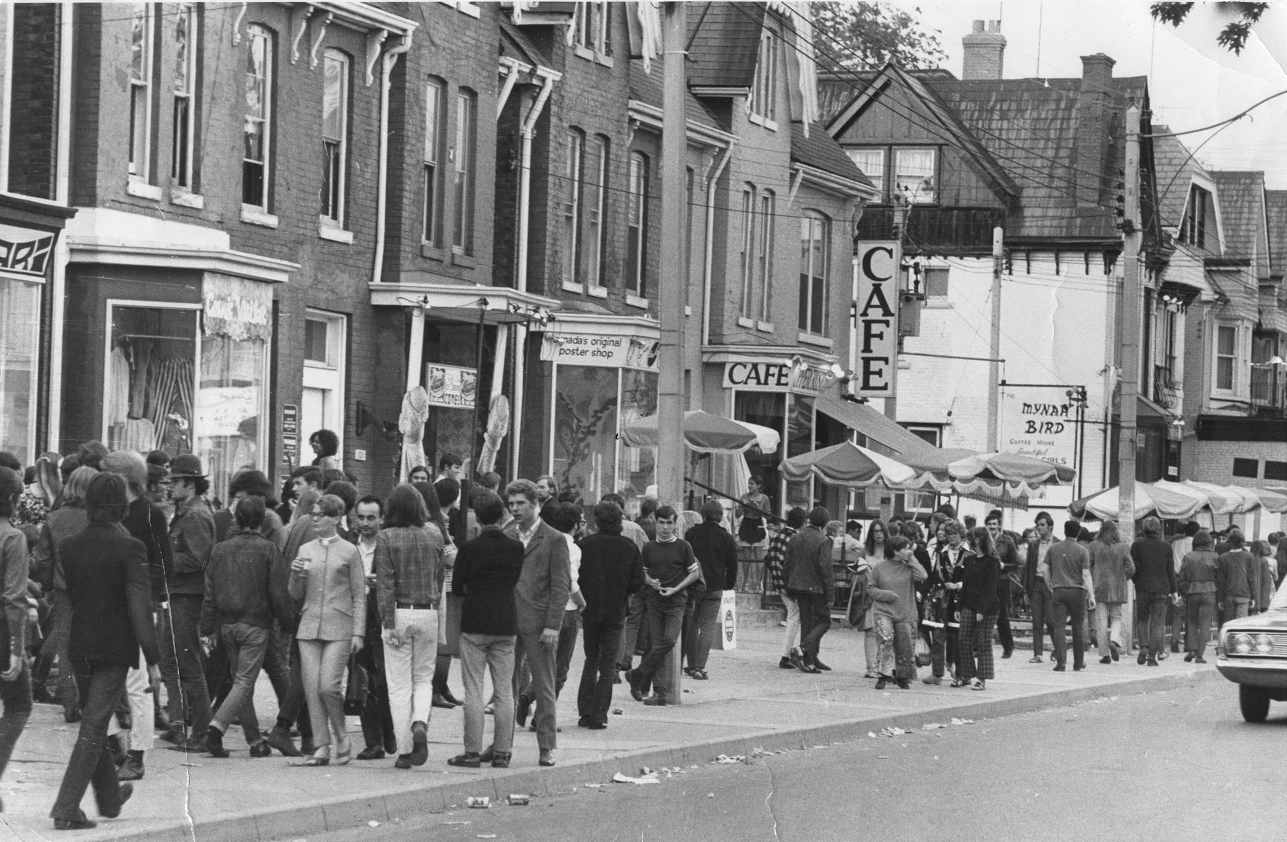
Click here to travel through time
In its heyday, Yorkville was a haven for hippies, folk music and smoky bars, but today, the area is home to luxury shopping and galleries. See how this community looked in the 1960s versus today.
Photograph by Reg Ignell, courtesy of Toronto Star Photo Archives, 1968.
Photograph by Vik Pahwa, 2019.
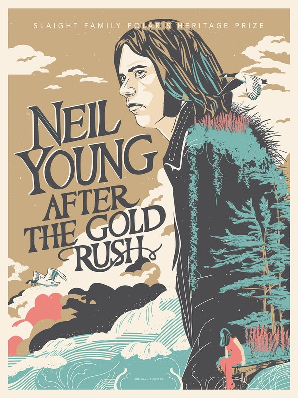
Poster honouring Neil Young's album 'After the Gold Rush' winning the Slaight Family Polaris Heritage prize in 2016.
Illustration by Jud Haynes.
Canadian legends such as Neil Young, Joni Mitchell , Gordon Lightfoot , Buffy Sainte-Marie , Leonard Cohen, Ian & Sylvia, and Bruce Cockburn shaped their music early on in the Yorkville music scene. In this sense, Yorkville became the birthplace of Canadian song and the Toronto Sound of the 1960s.
Some of the greatest lyrics in Canadian history were written on the streets of Yorkville and in the basement of its coffee houses and clubs.
Within a few short years, Yorkville had famously became a lightning rod for concerns about the corruption of youth and the immorality of “hippie” culture. Spurred simultaneously by public health concerns, traffic concerns and development proposals, Yorkville's organic counterculture was threatened.
In May of 1967 a "love-in" was held at Queen's Park in support of shutting down traffic on Yorkville Avenue. Performances by Leonard Cohen, Joni Mitchell , and Buffy Sainte-Marie were attended by over 4,000 people.
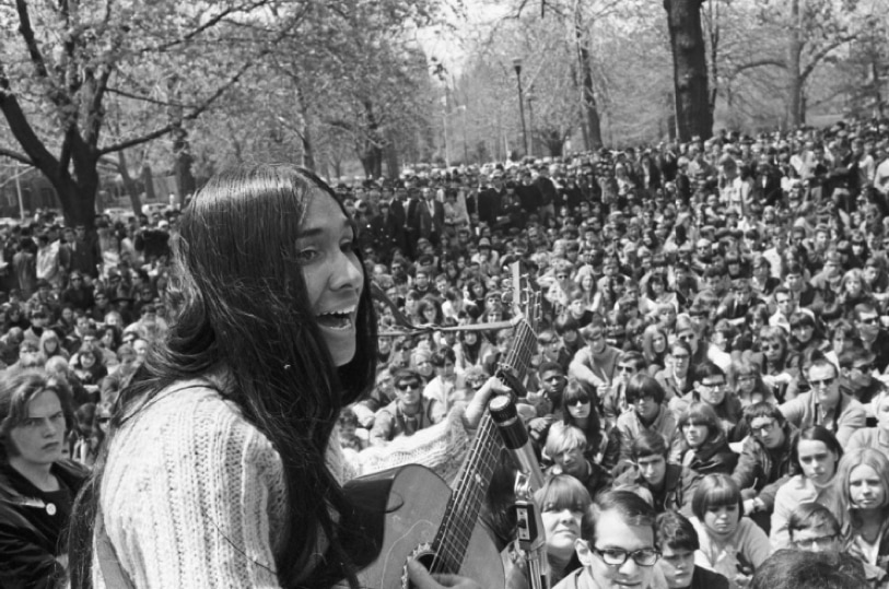
Buffy Sainte-Marie sings at the peaceful love-in at Queen’s Park in 1967.
Photo by Bill Dampier. Courtesy of the Toronto Telegram, Clara Thomas Archives and Special Collections, York University.
Night in the city looks pretty to me Night in the city looks fine Music comes spilling out into the street Colors go waltzing in time — Joni Mitchell, Night in the City
In August, peaceful protesters went one step further and organized a sit-in on Yorkville Avenue resulting in the arrest of 50 participants for traffic disruption. Police presence increased - perhaps mainly in response to Ontario MPP Syl Apps' accusation:
Yorkville was a "festering sore in the middle of the city."
Soon a paddy wagon was parked in the neighbourhood on the weekends and a 10 p.m. curfew was enforced for those under 18.
The decline of Yorkville came quickly thereafter with the closure of many prominent venues. The scene moved south and west, towards Markham Village and the University of Toronto campus, where Rochdale College – an experiment in student-run education – had just opened.
The Riverboat outlived the Yorkville's hippie heyday, closing in 1978.
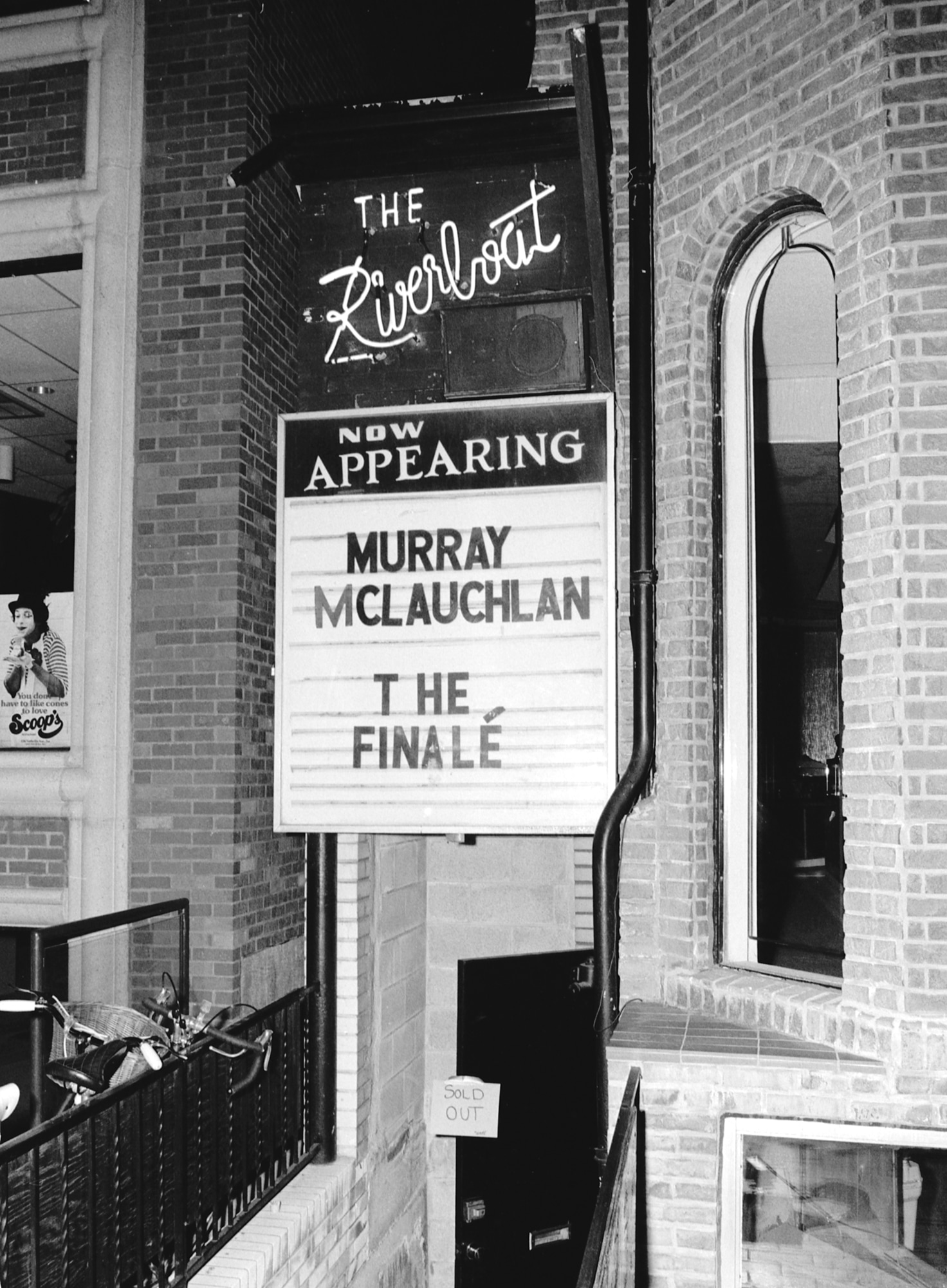
Hearing that it was closing night at The Riverboat, photographer Patrick Harbron quickly made his way down to the sold out venue one last time to hear Murray McLauchlan play. Photograph by Patrick Harbron.
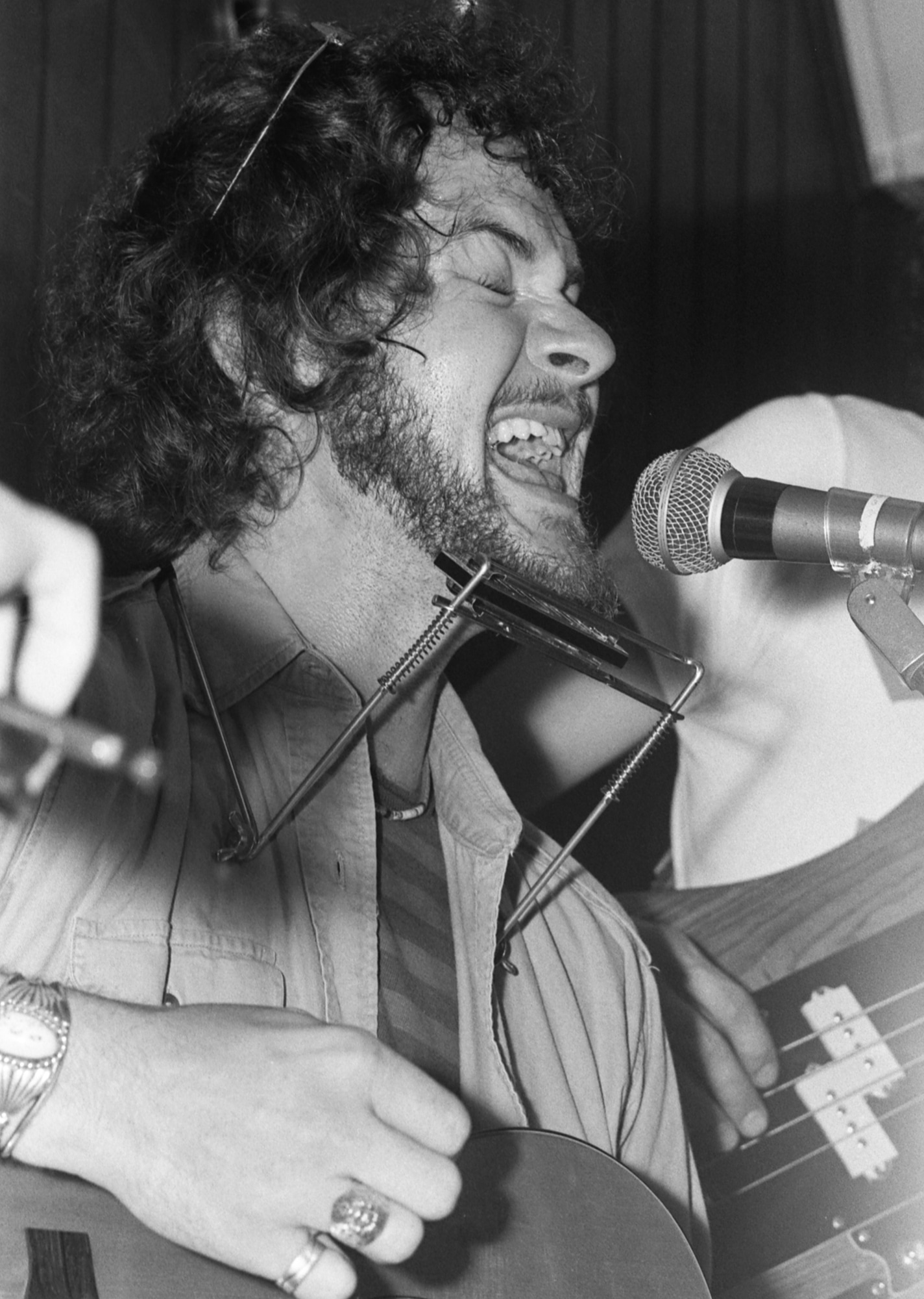
Have you ever been to a closing show at a music venue? Canadian songwriter Murray McLauchlan sings with full emotion, as he closes the Riverboat in the wee hours of June 25, 1978. Photograph by Patrick Harbron.
Dive Deeper
Christopher's Movie Matinee. Directed by Mort Ransen. Montreal: National Film Board, 1968. DVD.
Before the Gold Rush. By Nicholas Jennings. Toronto: Penguin Canada, 1998. Book.
Related Stories
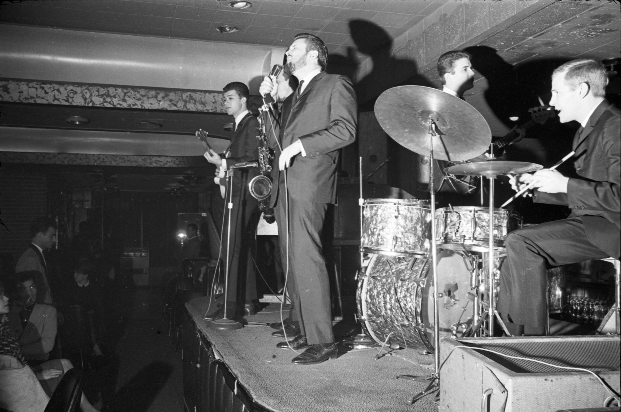
Le Coq d'Or
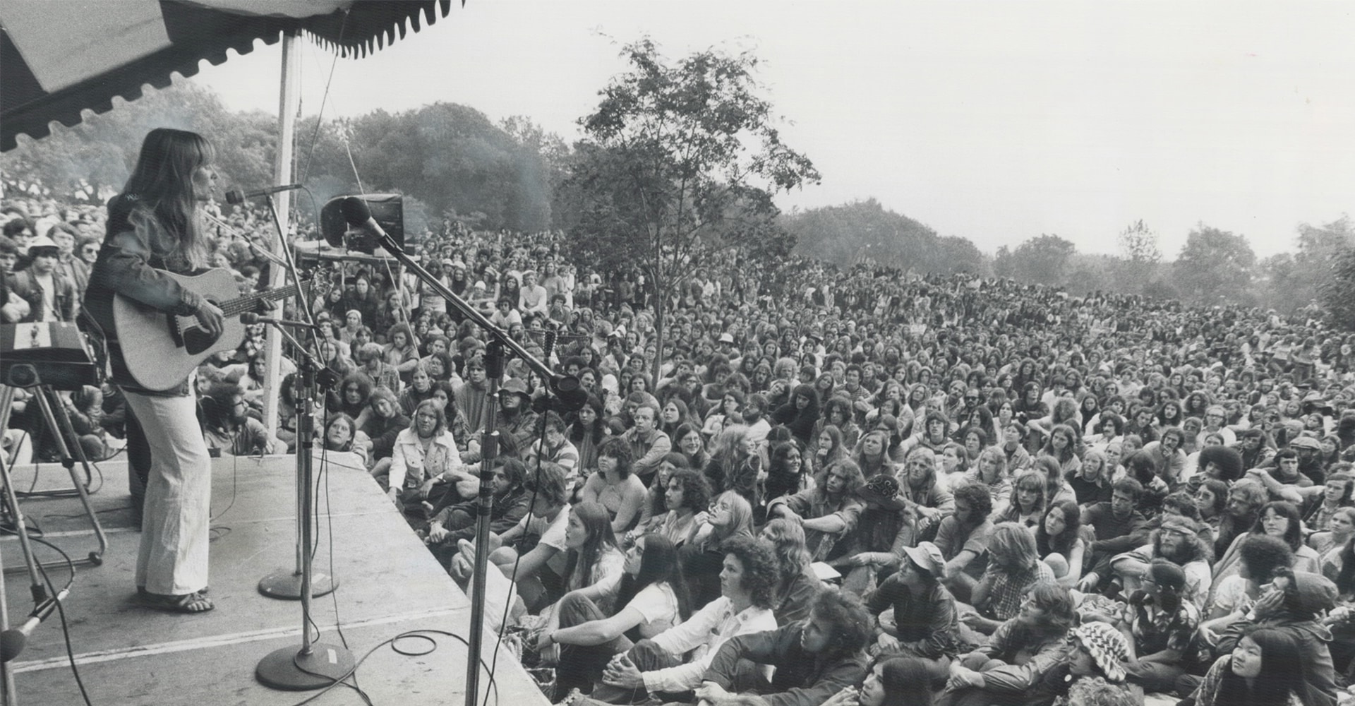
Joni Mitchell
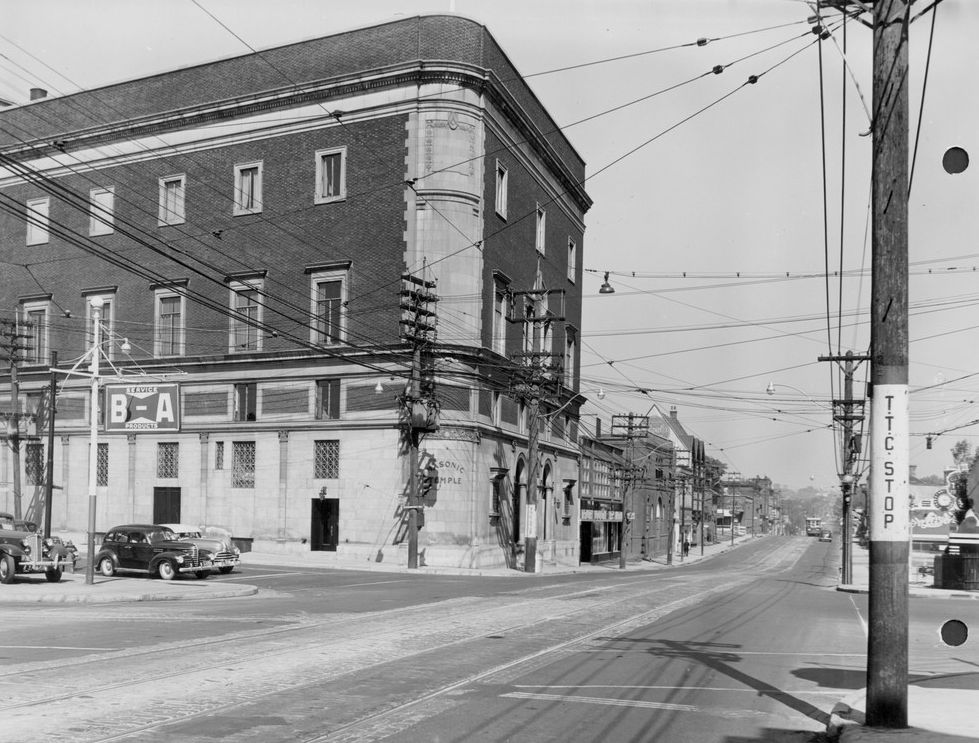
The Concert Hall
The Riverboat Coffee House opened in October, 1964 and quickly became part of a prestigious North American circuit that included Detroit’s Chess Mate and New York’s Bitter End. Situated below street level, the club seated 120 people in red booths amid pine walls and brass portholes.
Every seat was in close proximity to the stage, providing an intimate showcase of the top names in popular music, including howlin’ wolf, simon & garfunkel, sonny terry & brownie mcghee, tim buckley, ritchie havens, junior wells, john prine, ramblin’ jack elliott, arlo guthrie, buddy guy, kris kristofferson, john lee hooker, doc watson, tim hardin, jerry jeff walker, janis ian, steve goodman, odetta, seals & crofts and james taylor.s..

Uh oh… Looks like your browser is a bit behind the times.
Please install the latest version of one of these browsers to view this site:

Indigenous beginnings of the Don River Valley
The Don River and the surrounding Valley has a rich history in shaping and influencing Toronto’s identity.
Formed thousands of years ago by an ice age, the waterway became home to small groups of nomadic hunters.
Human settlement can be traced back as far as 7,000 years ago. Slate tools left behind by the Indigenous Peoples were discovered in 1886 during road building near Riverdale Park East.
The Indigenous groups that called the Don Valley home were drawn in by the value of the waterway.
Women made pottery from the surface’s clay deposits and Wendat longhouse villages were developed along the river starting in 1300 when corn became a staple food.
In 1700, Mississaugas moved into the region, seeing the Haudenosaunee withdraw south of Lake Ontario.
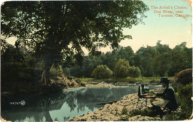
1787 saw the problematic “Toronto Purchase.” Believing the purchase to be a rental of the area, and not the release of their rights to the land, the Mississaugas surrendered most of the land that would become York, and then Toronto, to the British.
The Mississaugas opened a land claims settlement process with the Canadian government in 1986. In 2010, the claim settled in favour of the Mississaugas of the New Credit First Nation for $145 million.
Urbanization and the Don Valley
The Don River and surrounding Valley has played a vital role in the development of Toronto.
In 1795, the first sawmill was erected at Todmorden Mills, quickly followed by a paper mill and brewery.
These industries used the River to power their plants, and the industrialization of the Valley began.

Railways came next. The remnants of rails built in the late 1800s by the Canadian Pacific Railway can still be seen today during a walk in the Valley and through the Park.
The Taylor brothers, who operated Todmorden Mills, developed the Don Valley Brick Works in 1889, creating bricks out of the clay deposits found in the earth.
Now the Evergreen Brick Works , the site is home to 16 heritage buildings and the adjacent 16-hectare Don Valley Brick Works Park that includes wetlands, hiking trails, and wildflower meadows.

But where economy boomed, ecology and culture suffered.
Torontonians used to enjoy the Don River Valley: it was a community focal point, accessible and celebrated as a part of Toronto’s early identity.
Imagine a Lower Don river teeming with salmon and flowing through wide marshes and up against banks lined with trees.
Such was the reality for the river in the 1800s, but over the last 200 years, the Don watershed has faced immense pressure due to human settlement and urbanization.
Hard paved surfaces encourage flooding, as they prevent stormwater from seeping into the soil or being soaked in by plants.
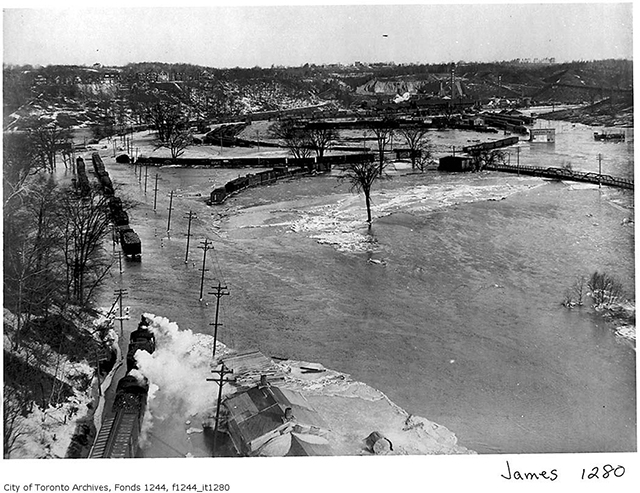
Sewers, carrying both stormwater and sanitary sewage, flood into the river during large storms, which occur more and more frequently with the changing climate.
We are facing these challenges by encouraging dialogue and creative designs as well as supporting the city’s infrastructure projects. We’re envisioning the Don River Valley Park to be one of the largest environmental restoration projects across Canada.
Did you know?
It may be hard to imagine a time when the Don Valley was teeming with life and culture at its banks, but that was the reality in the 1900s. Here are some more interesting facts about the history of the Don Valley:
The Don River was actually straightened. The lower portion of the Don used to meander its way through marshland to its mouth at Ashbridges Bay. In the 1880s, the river was straightened to accommodate industrial development in the Port Lands and allow polluted water to flush into the lake.

The Port Lands used to be home to one of Lake Ontario’s largest marshes. A lot of the wetlands were destroyed by municipal landfill between 1912 and 1925.
The River was a place to swim . In the hot summer months, residents flocked to the Don River for a swim, perhaps at one of the River’s “bare-bottomed” beaches. Some people even had vacation homes along the River.

Hurricane Hazel caused the Don and Humber rivers to flood the city . Nowadays we know how the Don can flood in times of sudden rain, but in 1954, Hurricane Hazel forced the entire city underwater. The Metropolitan and Toronto Region Conservation Authority was created in the wake of the flood, and among its defining achievements is the acquisition of ravine lands.
The Don Valley was the place to ski. Citizens of Toronto didn’t have to travel very far to be able to put on a pair of skis in the 1930s. The city even operated a ski hill in the Valley.
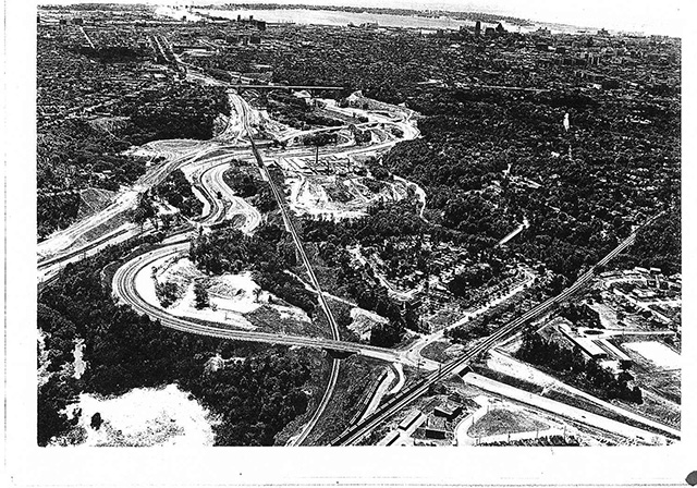
The Don Valley Parkway opened in 1961. Proposed in 1954, it wouldn’t be until 1961 the parkway would open, forever changing the Don Valley. The hills of the Valley were modified and other natural areas destroyed by the creation of the highway during the post-war boom in Toronto.
Search The Canadian Encyclopedia
Enter your search term
Why sign up?
Signing up enhances your TCE experience with the ability to save items to your personal reading list, and access the interactive map.
- MLA 8TH EDITION
- Barris, Ted. "Steamboats and Paddle Wheelers". The Canadian Encyclopedia , 04 March 2015, Historica Canada . www.thecanadianencyclopedia.ca/en/article/steamboats-and-paddle-wheelers. Accessed 25 April 2024.
- The Canadian Encyclopedia , 04 March 2015, Historica Canada . www.thecanadianencyclopedia.ca/en/article/steamboats-and-paddle-wheelers. Accessed 25 April 2024." href="#" class="js-copy-clipboard b b-md b-invert b-modal-copy">Copy
- APA 6TH EDITION
- Barris, T. (2015). Steamboats and Paddle Wheelers. In The Canadian Encyclopedia . Retrieved from https://www.thecanadianencyclopedia.ca/en/article/steamboats-and-paddle-wheelers
- The Canadian Encyclopedia . Retrieved from https://www.thecanadianencyclopedia.ca/en/article/steamboats-and-paddle-wheelers" href="#" class="js-copy-clipboard b b-md b-invert b-modal-copy">Copy
- CHICAGO 17TH EDITION
- Barris, Ted. "Steamboats and Paddle Wheelers." The Canadian Encyclopedia . Historica Canada. Article published April 08, 2009; Last Edited March 04, 2015.
- The Canadian Encyclopedia . Historica Canada. Article published April 08, 2009; Last Edited March 04, 2015." href="#" class="js-copy-clipboard b b-md b-invert b-modal-copy">Copy
- TURABIAN 8TH EDITION
- The Canadian Encyclopedia , s.v. "Steamboats and Paddle Wheelers," by Ted Barris, Accessed April 25, 2024, https://www.thecanadianencyclopedia.ca/en/article/steamboats-and-paddle-wheelers
- The Canadian Encyclopedia , s.v. "Steamboats and Paddle Wheelers," by Ted Barris, Accessed April 25, 2024, https://www.thecanadianencyclopedia.ca/en/article/steamboats-and-paddle-wheelers" href="#" class="js-copy-clipboard b b-md b-invert b-modal-copy">Copy
Thank you for your submission
Our team will be reviewing your submission and get back to you with any further questions.
Thanks for contributing to The Canadian Encyclopedia.
Steamboats and Paddle Wheelers
Article by Ted Barris
Published Online April 8, 2009
Last Edited March 4, 2015

Further Reading
Ted Barris, Fire Canoe: Prairie Steamboat Days Revisited (1977); Peter Charlebois, Sternwheelers & Sidewheelers, The Romance of Steamdriven Paddleboats in Canada (1978); Art Downs, Paddlewheels on the Frontier; The Story of British Columbia and Yukon Sternwheel Steamers (1972).
Recommended
Canada steamship lines inc.
History Of Toronto
spans more than 10,000 years
- Toronto History
An overview of Toronto’s History
The French Colony (1615-1760)
The first European to set foot on the shores of Lake Ontario in the vicinity of what is now Toronto was French explorer Étienne Brûlé. He was part of the expedition led by Samuel de Champlain in 1608 that resulted in the founding of Quebec. However, the Toronto region had been inhabited for at least ten thousand years before the arrival of Brûlé in 1615. The indigenous inhabitants of the region were well acquainted with Toronto, as it was situated along a series of trails and water routes that connected northern and western Canada with the Gulf of Mexico. The “Toronto Passage” or “Toronto Carrying Place,” which followed the Humber River, constituted an important overland shortcut between Lake Ontario and the upper Great Lakes. The region was populated by the Huron and Petun tribes until approximately 1600, when they withdrew to land south of Georgian Bay. The Iroquois League, who lived south of Lake Ontario, were their rivals, and feuding between Iroquois and Hurons continued into the 17th century as French fur traders began to move into the area. By the mid-17th century, the Huron Confederacy had been significantly weakened by the introduction of foreign diseases brought by the French and conflict with the Iroquois, who subsequently occupied some of the former Huron territory on the north shore of Lake Ontario. The French subsequently dislodged the Iroquois in 1688, and the vacant lands were subsequently taken up by the Mississaugas from the Canadian Shield.
In the latter part of the 17th century, a village emerged on the east bank of the Humber River, in the vicinity of the present-day Old Mill. Called Teiaiagon, the village served as a trading post and a meeting place for traders from the east (French), north (Indian), and south (English). Its strategic location at the convergence of three significant trade routes and on the Toronto Passage, a shortcut to the upper Great Lakes and northwestern Canada, contributed to its prominence. Over time, the population of Teiaiagon consisted of a shifting amalgam of Mississaugas, Senecas (Iroquois), French fur traders and soldiers, and missionaries, such as the Jesuits. Concurrently, the French were establishing themselves along the St. Lawrence River and at Teiaiagon, while the British were setting up flourishing colonial settlements along the Atlantic Coast in New England and Chesapeake Bay. The hostilities that existed between Britain and France in Europe were carried over into the colonial settlements, resulting in intense rivalries between the two countries as they vied for control of the fur trade and other resources. The French and Indian War (1754-1763) was the result of this rivalry, as the two countries fought for control of the North American continent with the assistance of colonial and Native allies. This conflict subsequently expanded into Europe, becoming known as the Seven Years’ War (1756-1763).
In the course of events, various forts and blockhouses were constructed by the French and English along the shores of Lake Ontario and elsewhere. In 1750, the French constructed Fort Toronto on the east bank of the Humber River. However, it was soon perceived to be inadequate in comparison with British forts like Fort Oswego. Consequently, a larger French fort, called Fort Rouille, was constructed three miles east of the Humber, on the grounds of the present-day Canadian National Exhibition. This was the final French fort in the Toronto area. By September 1760, the British had vanquished the French, who subsequently withdrew from North America, thereby bringing an end to French rule in what would later become Canada.
For the subsequent three decades, the Toronto area was under British control, although their presence was barely discernible. The fur trade was revived, with passes being issued by the British commander Lord Dorchester at Montreal for trappers to hunt at Toronto. In 1787, he negotiated the Toronto Purchase, which transferred the title to a fourteen-mile stretch of land along Lake Ontario from present-day Scarborough to Etobicoke, and nearly 30 miles inland, from the Mississauga Indians to the British. In exchange for relinquishing over 250,000 acres of land, the Mississaugas received 1700 pounds sterling and various goods. The American Revolution, which occurred between 1775 and 1783, had no pronounced effect on Toronto at the time. However, the post-revolution migration of Loyalists to populate the area north of Lake Ontario from the upper St. Lawrence west to Kingston, the Bay of Quinte, and Niagara regions would have a significant impact on the subsequent development of Upper Canada. Furthermore, the delineation of the border along the middle of the Great Lakes, following the recognition of the United States as a non-British entity in 1783, facilitated the formation of a distinct Canadian identity and contributed to the advancement of Toronto as a logical choice for the center of British influence.
Governor Simcoe’s Village (1793-1812)

In 1791, Britain divided the colony of Quebec into the provinces of Upper and Lower Canada. The former encompassed the area now known as Ontario, which was initially populated largely by Loyalists. The latter included the present-day province of Quebec, which remained predominantly French. The impetus for dividing the colony into two separate provinces had come from the Loyalists, who objected to having French laws and culture imposed on them in their new surroundings. Consequently, the two provinces exhibited distinct cultural, legal, and land tenure characteristics, as well as separate elected assemblies representing their respective interests. In 1792, John Graves Simcoe, the inaugural Lieutenant Governor of Upper Canada, arrived at Newark (now Niagara-on-the-Lake). Simcoe had served with the British forces during the American Revolution as the commander of a Loyalist regiment called the Queen’s Rangers. Although both Newark and Kingston were already established towns in Upper Canada, Simcoe believed that Toronto was a superior site for the capital from a military and naval standpoint. On July 30, 1793, Simcoe arrived at Toronto with his wife, Elizabeth, their servants, and members of the Queen’s Rangers, who would serve both as soldiers and laborers in establishing the new town.
Unfortunately for Simcoe, his superior Lord Dorchester did not concur with his assessment of Toronto as the optimal location for a military and naval stronghold in Upper Canada. Dorchester favored Kingston, and since he was the authority on military expenditures, Simcoe lacked the financial backing he needed. Nevertheless, he was able to oversee the construction of a log hut garrison, the laying out of a ten-block town site, and 100-acre park lots north of the town, running from Queen Street (originally called Lot Street) up to Bloor. Simcoe intended to give these lots to government officials from Niagara as compensation for having to move to what was then a wilderness outpost. Additionally, he initiated the clearing of Yonge Street up to the Holland River, which opened the lands above the town to wider settlement and provided a vital link to the town’s markets. Simcoe ordered the Queen’s Rangers to erect the first modest public buildings of the town, including those for parliament, courts, and religious services. He also gave a new name to the town, calling it York, after the British commanding general the Duke of York. In the fall of 1796, Simcoe returned to Britain on leave and was reassigned to military duties in the West Indies. Although his tenure in York was relatively brief, he played a pivotal role in laying the foundation for the city’s future growth and prosperity.
In the years following Simcoe’s departure, the town continued to grow at a modest rate. At the first town meeting in July 1797, 241 inhabitants were enumerated. The initial population at York consisted of British officials and their families, soldiers, and a small assortment of laborers, storekeepers, and craftsmen. Contemporary correspondence indicates that labor and materials were in such short supply in York’s formative years that not only were costs driven up but the ruling class often had to wait to have their homes built. This demand served to attract shopkeepers and skilled tradesmen to the town, which by 1812 had a population of a little over 700. In the decade preceding 1812, numerous new edifices were erected, including inns and hotels, a jail, two new military blockhouses situated to the east and west of the town, and in 1807 the inaugural church, known as “the English Church” but subsequently designated St. James. The land surrounding York continued to be developed, primarily by post-Loyalist Americans who eagerly embraced the rich farmland situated to the east and west of Yonge Street above the town. As York expanded and transportation to and from the town improved, merchants began to arrive who carried a larger and more varied selection of goods, and who imported their products directly from Britain or New York rather than obtaining them from Kingston or Montreal, which were both larger and more established towns. Socially, the population was divided into two distinct groups: The official ruling elite comprised a close-knit group of upper-class and distinctly British families who held the reins of power and were favoured with special privileges, including the grant of large “park lots” north of the town (which were later christened “The Family Compact”). In contrast, the working-class merchants, labourers and craftsmen constituted a significant proportion of the population. One notable aspect of York’s social structure was that it did not have a Loyalist foundation; its inhabitants were thoroughly British. The farm settlements above the town were predominantly populated by Loyalists and recently arrived Americans. This demographic would become significant during the conflict with the United States and the events leading up to the Rebellion of 1837. However, prior to the War of 1812, Governor Simcoe’s vision for York was gradually becoming a reality.
History of Riverside
Riverside runs alongside the Don River – an icon in Toronto’s landscape and history. The name ‘Riverside’ dates back to the 1880s. As you wander Queen Street East in the heart of Riverside, note the curving blue brick ‘river’ in the sidewalks and the public art referencing that connection throughout. The residential landscape within the Riverside neighbourhood is comprised of primarily Victorian and Edwardian style homes constructed in the 1800s. These homes were previously used as boarding rooms for the working-class. Industries declined in the second half of the 20th century and during the 1980s and early 1990s the area experienced significant economic difficulties.
Over the last 30 years, Riverside has undergone significant revitalization and gentrification. Many of the buildings and residences have preserved the historic architecture of the building and modernized the interiors to reflect the diversity and pay homage to the fusion of old and new in the neighbourhood.
Read the ‘Uncovering Riverside’ blog series for more about the history of Riverside:
#1 Uncovering the History of Riverside: An Introduction – The story starts with how, when and why Riverside got its name
#2 Uncovering the Sport and Game of Riverside – Learn about the early days of sport and game in Riverside
#3 Uncovering the Holiday Season in Riverside Past & Present – Learn about early holiday traditions, personalities, and life in Riverside
#4 Uncovering Riverside: A Curler’s Valentine – Read about Riverside’s long-time love affair with curling and links to personalities of the past
#5 Uncovering Easter in Historic Riverside – Read about Easter in Riverside past and more baseball links
The series is a partnership with local historian Barry Slater of the Royal Canadian Curling Club .
Check out the Riverside Architecture Self-Guided Walk
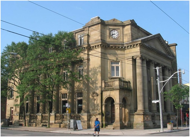
Postal Station G – Ralph Thornton Centre – Riverside Toronto


20 years with the Toronto Reservoir
Stay informed about your community and support local independent journalism.
Subscribe to The River Reporter today. click here
BETHEL, NY — After 20 years of struggle, the Toronto Reservoir access remains open to the public.
The Friends of the Toronto Reservoir (FOTR) held its 20th anniversary celebration on August 24, celebrating the success of that struggle and that the reservoir remains open.
The reservoir is one of five in the Mongaup River system. It is licensed to an electric utility company, currently Eagle Creek Renewable Energy, for the purpose of generating hydroelectric power. As part of the condition of the lease, Eagle Creek has to maintain a pair of access points allowing the public to use the reservoir for swimming, fishing and kayaking.
Over the 20 years that FOTR has watched over the reservoir, it has fended off a number of attempts to curtail public access.
Woodstone Development, which built the nearby gated community Chapin Estates, advertised the reservoir as a private lake attached to its development, said Nino Nannarone, FOTR chair; “This is talk about private gain. They wanted to eliminate this water and make it their water, not the public’s water.”
Woodstone placed boulders and walls across the access points, and petitioned the Federal Energy Regulatory Commision (FERC) to change the license attached to the reservoir, petitioning for one required access point instead of two. Despite acquiring support from multiple levels of government, Woodstone failed in its attempts, causing it to remain a public access, according to FOTR.
Later on, a Chapin Estates resident asked the state Department of Health (DoH) to declare the access area a beach that would require lifeguards and supervision, and to close it because it lacked those qualities, per coverage in the River Reporter . Following an administrative hearing, the DoH appeals court declared that the federal license for the access superseded state requirements and the DoH could not close it.
“To encapsulize it, it has been a long, drawn-out, needless fight, because when you know that you have the law on your side, you’re supposed to know that the law’s going to prevail,” said Bob Barrett, one of the most longstanding members of FOTR. “But it does not prevail when you do not get the support of those who are supposed to enforce the law.”
While FOTR has succeeded in keeping the reservoir open, the group is still working to improve access in the area.
The road that leads to the public access has a number of potholes and is poorly maintained; FOTR has kept pressure on Eagle Creek to properly inspect and maintain the road. In addition, FOTR wants Eagle Creek to put in a walking path by the reservoir itself.
Eagle Creek is seeking a 30-year renewal license from FERC, allowing it to continue using the reservoir for hydroelectric power generation. FOTR wants to petition FERC to include both maintenance of the access road and installation of a walking path in the terms of the license, thus requiring Eagle Creek to comply.
Preserving public access to the natural resource of the Toronto Reservoir is important going forward, FOTR believes.
There aren’t many free options for public swimming anymore, said Cissy Goldfarb, a longstanding member of FOTR. “I feel that there’s a big fear that younger people are not going to become involved. People are having to spend so much time and money to support themselves, and they don’t recognize the wolf at the door, what’s going to happen in the future.”
“Everybody [in FOTR] is getting older, and I don’t know who’s going to carry a fight forward against the powers [that be]—they’re going to live a wonderful life, and the other people are not going to have that much,” said Goldfarb.

No comments on this item Please log in to comment by clicking here
Related stories
Pavilion not yet out for bid
Tusten youth can expand, thanks to county funds, feuding highland officials to meet with mediator, special counsel hired for highland conflict of interest.
$14.5M gold heist from Toronto airport results in charges for airline employee and 8 other people
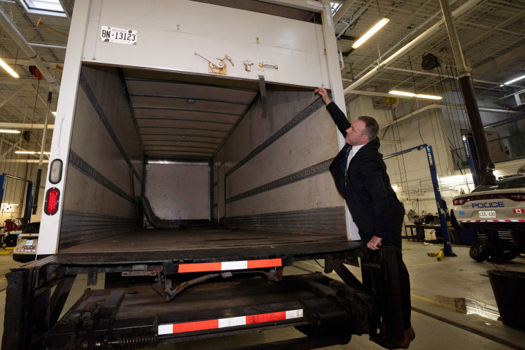
TORONTO — Police said nine people are facing charges in what authorities are calling the biggest gold theft in Canadian history from Toronto’s Pearson International airport a year ago.
Peel Regional Police said Wednesday that 6,600 gold bars worth more than 20 million Canadian dollars ($14.5 million), and CA$2.5 million ($1.8 million) in foreign currencies were stolen. The gold was melted down and used to purchase illegal firearms, police said.
Those charged include a Air Canada warehouse employee and a former Air Canada manager who gave police a tour of cargo of the facility after the theft. A jewelry store owner is also charged.
“This story is a sensational one and which probably, we jokingly say, belongs in a Netflix series,” Peel Regional Chief Nishan Duraiappah said.
Peel Reginal Detective Sgt. Mike Mavity said the gold bars, weighing 419 kilograms (923 pounds), and foreign currency, ordered from a refinery in Zurich, Switzerland, were transported in the haul of a Air Canada flight on April 17 last year.
He said that late afternoon a truck driver arrived at the airline’s cargo warehouse with a fraudulent bill that was provided to a airline warehouse attendant.
Mavity said a bill for seafood that was picked up the day before was used to pick up the gold. The duplicate bill was printed off at the Air Canada warehouse, he said.
“They needed people within Air Canada to facilitate this theft,” Mavity said in front of the truck police say was used in the theft.
Mavity said police are searching for the Air Canada manager who gave police a tour of the facility in the days after the theft. He said that manager left his job last summer and said they have an idea of where he is.
Mavity said some of the suspects were known to police and some were not. He said they seized six crudely made bracelets made of gold.
“I don’t think I ever imagined they would have to deal with the largest gold heist in Canadian history,” said Patrick Brown, the mayor of Brampton, Ontario. “It’s almost out of an ‘Ocean’s Eleven’ movie or CSI.”
Air Canada employee Parmpal Sidhu, 54, from Brampton, Ontario, jewelry store owner Ali Raza, 37, from Toronto, Amit Jalota, 40, a Oakville, Ontario resident, Ammad Chaudhary, 43, from Georgetown, Ontario and Prasath Paramalingam, 35, from Brampton are among those that have been arrested. Mavity said they have been released on bail conditions and will be in court at a later date.
Mavity said the truck driver that allegedly picked up the gold, Durante King-Mclean, a 25-year-old from Brampton, is currently in custody in the U.S. on firearms and trafficking related charges.
Police are searching for former Air Canada manager Simran Preet Panesar, 31, from Brampton as well as Archit Grover, 36, from Brampton and Arsalan Chaudhary, 42, from Mississauga Ontario.
Peel Regional Deputy Chief Nick Milinovich said only CA$90,000 ($65,00) of the more than CA$20 million has been recovered.
U.S. ATF Special Agent, Eric DeGree, said King-Mclean, was arrested in Pennsylvania after a traffic stop and that led to the seizure of 65 illegal firearms that were allegedly destined to be smuggled into Canada. DeGree said he tried to flee after police discovered the firearms in his rental car.
Brinks, an American cash handling company, arrived at the airport cargo facility the night of April 17 to pick up the gold and were told the gold and currency was missing after a search.
Brinks sued Air Canada over the theft last year. According to the company’s filing last year, a thief walked away with the costly cargo after presenting a fake document at an Air Canada warehouse on April 17.
In a Nov. 8 statement of defense, Air Canada rejected “each and every allegation” in the Brink’s lawsuit, saying it fulfilled its carriage contracts and denying any improper or “careless” conduct.
The country’s largest airline also said Brink’s failed to note the value of the haul on the waybill — a document typically issued by a carrier with details of the shipment — and that if Brink’s did suffer losses, a multilateral treaty known as the Montreal Convention would cap Air Canada’s liability.
In Federal Court filings that claim breach of contract and millions of dollars in damages, Brinks said an “unidentified individual” gained access to the airline’s cargo warehouse and presented a “fraudulent” waybill shortly after an Air Canada flight from Zurich landed at Pearson.
The statement of the claim says the staff then handed over 400 kilograms of gold in the form of 24 bars plus nearly $2 million in cash to the thief, who promptly “absconded with the cargo.”
DeGree said dozens of firearms authorities were seized, including two fully automatic weapons and five guns that were untraceable.
“I’m proud to say that we successfully put an international gun trafficking operation out of business. We kept 65 firearms off the streets of Canada and prevented them from being used in any number of crimes,” DeGree said.
Mavity said that “we believe they melted down the gold and with the profits they got from the gold they used to purchase illegal firearms.”
The Associated Press
Could the 31st Edition of Hot Docs Be the Last for the Ailing Toronto Fest? Organizers Warn It Might Be
By Addie Morfoot
Addie Morfoot
Contributor
- Could the 31st Edition of Hot Docs Be the Last for the Ailing Toronto Fest? Organizers Warn It Might Be 16 hours ago
- ‘Invisible Nation’ From Veteran Indie Producer Ted Hope Sells to Abramorama (EXCLUSIVE) 2 days ago
- Andrew Jarecki Addresses Lingering Ethical Concerns About ‘The Jinx’ and Explains Why He Wanted to Revisit Robert Durst’s Crimes 4 days ago

The 31st edition of Canada’s influential Hot Docs Film Festival, which gets underway Thursday, could very well be the last.
Popular on Variety
The financial woes facing Hot Docs aren’t surprising given the fact that film festivals all over the world are struggling financially. COVID hit many non-profit film festivals hard and many have yet to recover. Both big and small fests are battling drastically shrinking revenues due in part to poor ticket sales and weakening sponsorships, donations and grants. Last August, the Toronto Intl. Film Festival lost its lead sponsor Bell after 28 years. In April at the Mill Valley Film Festival, founder and Director Mark Fishkin announced that the California Film Institute — the nonprofit that runs the fest — was half a million dollars in the red. As of May 2023 Hot Docs, according to Canada Revenue Agency report, had a $1.5 million deficit. Fishkin and Nelson, are asking for personal donations to keep their respective festivals standing.
While the doc fest’s financial situation is dire, the internal war that appeared to transpire behind the scenes was a seismic blow. Losing 10 seasoned programmers one month before a festival that includes a slate of 168 films is potentially catastrophic.
On March 25 in a joint statement on social media, as first reported by Screen Daily , Hot Docs senior international programmer Myrocia Watamaniuk wrote, “I have made the heartbreaking choice to exit the 2024 Hot Docs Festival. I do so with 9 of my fellow colleagues, listed below. I will continue to fight for films and filmmakers — they are the bedrock of all film festivals, and the reason I do this job.”
Watamaniuk had been with Hot Docs since 2001.
Watamaniuk and the nine programmers who left Hot Docs put together the 31st edition of the fest prior to their departure. The 10 programmers who exited alongside Watamaniuk are: Samah Ali (international programmer, features, 2020–2024), Vivian Belik (international programmer, mid-lengths, 2020–2024), Jesse Cumming (international programmer, markers, 2021–2024), Angie Driscoll (senior international programmer, features and shorts, 2003–2024), Margaret Pereira (international programmer, mid-lengths, 2023–2024), Gabor Pertic (international programmer, features, 2010–2024), Kaitlynn Tomaselli (international programmer, features, 2023–2023), Mariam Zaidi (international programmer, shorts and Canadian programmer, features and shorts, 2016–2024) and Yiqian Zhang (Canadian programmer, features and shorts, 2023–2024).
An internal letter dated Feb. 20 and addressed to the Hot Docs board of directors and senior management, which was obtained by the Toronto Star , states that the programmers’ workplace had been turned upside down due to Currimbhoy, the now departed artistic director. Currimbhoy, who had stints at Sundance, Sheffield DocFest, and the Melbourne Film Festival, was hired by Hot Docs in November 2023.
“We have individual stories and experiences to share, which all speak to a pattern of disrespect, dismissal and degradation by artistic director Hussain Currimbhoy and supported by senior management,” the letter allegedly stated.
A source who did not want to be named says that Hot Docs’ decision to let Currimbhoy state that he had chosen to “step down” for personal reasons as opposed to being fired triggered the 10 programmers to leave before, and not after, the festival. They also wrote a public follow up to their first statement.
In a statement to Variety , all 10 programmers said, “Due to a confidentiality clause in our contracts, we are faced with the very real fear of legal repercussions and this intimidation prevents us from speaking to any specifics, even anonymously, at the moment,” adding that they believe it important “to correct inaccuracies in the narrative and timeline being presented by Hot Docs and others, so as to prevent this from ever happening again. We hope we will be able to do so soon.
“Our audience and filmmakers are our first priority and we would like this to be understood before the festival begins so their experiences won’t be compromised in any way.”
During a press conference last month Nelson said, “We understand that our union is far from perfect, but I also know that the only way we can create a more perfect union is if we do it together, and so I will continue to work to try to earn that trust and hope that (the programmers) will come back, and if they don’t come back this year that they’ll come back next year.”
Charlotte Cook, who served as Hot Docs director of programming from 2011 to 2015, describes the programmers who left the fest as “some of the most passionate, dedicated programmers I’ve ever interacted with.” Cook, who co-founded and runs the non-profit documentary production studio Field of Vision, fears that the film community doesn’t place enough value on festival programmers.
“There’s a huge amount of skill that goes into being a programmer and choosing films for a festival, there is a lot more that goes into it than is often perceived,” Cook says. “I worry that the skill of programming is being undervalued across the field. I think many people think being a programmer is just sitting around and watching a ton of films and it’s obvious which to choose, and it’s an easy job.
“In programming you’re watching rough cuts, you’re balancing a program to make sure it’s reflective and inclusive of so many factors, serving both the filmmakers and your audience. It isn’t simply about taste, far from it.”
She worries that a lack of appreciation for the skill required to program festival will lead to more problems at festivals.
“To give up a programming job like the Hot Docs jobs is a very, very difficult decision,” Cook says. “It is incredibly difficult to maintain a living as a programmer. I think any kind of perception that it was a reactionary move or a non-supportive move towards the festival is just something I can’t even compute knowing that group of people.”
Dawn Porter , whose film “Luther: Never Too Much,” about R&B star Luther Vandross is opening Hot Docs, says that directors who have been invited to the fest have been reassured that this year’s edition will be without any hiccups. But despite the assurances, Porter is concerned.
Yance Ford will be at Hot Docs with “Power,” a Netflix doc about the history of American policing. Ford said that he never considered pulling out of the festival despite behind the scenes concerns.
“I used to be a programmer, so I know that programming is not something that you just dial in,” Ford says. “Programming is something that you invest in because it says something about the festival and it says something about you and your vision as a programmer. So for 10 of them to leave at once was shocking.
“How does one respond to their sudden departure? It seemed to me that we filmmakers had an obligation to meet the ticket holders and the audiences at Hot Docs as expected,” Ford says “It’s an incredible festival. The audiences are amazing. So, in the absence of any concrete knowledge I felt like we still have to go to the festival.”
Also attending is filmmaker Gary Hustwit with “Eno,” about visionary musician and artist Brian Eno. The film’s producer Jessica Edwards said she was initially “super nervous” going to the Toronto fest.
“I wasn’t sure what it would look like logistically,” Edwards says. “I wasn’t sure how it would feel in the theaters. I wasn’t sure about the tech team and hospitality and the sort of machine that works to get a filmmaker to a festival. We didn’t hear from the festival for a couple of days after everything went down and then we got an email and it was reassuring and welcoming.
“Gary and I spent a lot of time talking about it and what was important to us was the idea that you support the things that support you. So we are very excited to bring ‘Eno’ to Toronto audiences. If Hot Docs, God forbid, goes away then filmmakers will have lost the opportunity to connect directly to their audiences and that makes me very sad.”
More From Our Brands
Nicki nicole reminds an ex what he’s lost on ‘ojos verdes’, royal huisman is building the world’s tallest sailing yacht, get ready for the ai-ified olympic games, be tough on dirt but gentle on your body with the best soaps for sensitive skin, ahs: delicate finale delivers ominous, abrupt ending — grade it, verify it's you, please log in.

How to hear Virginia’s ‘forgotten’ history along the James River
Jessica Kronzer | [email protected]
April 22, 2024, 5:28 AM
- Share This:
- share on facebook
- share on threads
- share on linkedin
- share on email
Two Virginia men are hoping to change that.
Will Smith and Will Cash, or the Wills (as they’re often called), bring customers aboard a replica of an 18th century batteau. While the word borrows from the French term for “boat” (bateau), the vessels were mostly used in North America as freight haulers during the colonial period.
The Wills hope to share the largely forgotten history of the boatmen who built a community on the James River.
“There was a lot of people that put a lot of work in, whose stories are disappearing all the time,” Smith, 36, told WTOP. “We see ourselves as being able to carry that torch on, making sure people … are able to really take that in and understand the state as it is today.”
The river tours set out from Scottsville, Virginia, a small town just south of Charlottesville.
During the early 1700s to mid-1800s, batteaux were navigated mostly by enslaved and freedmen who transported goods, oftentimes tobacco, from Virginia’s Piedmont to the markets in Richmond.
The men would then row back up the river, hauling goods that plantation owners wouldn’t otherwise have easy access to, such as coffee, tea, molasses and sugar.
Smith and Cash are longtime friends. They co-own the James River Batteau Company , offering river cruises with light acoustic music and flavorful charcuterie in the afternoon and at sunset. The pair rows groups of customers while retelling the stories of the batteaumen who spent their time on the same passageway.
Nancy Gill, a former mayor of Scottsville and the host of the James River Podcast, is somewhat of a superfan. She’s taken three tours with the Wills.
“You don’t get from a history class or a textbook, what you get going out on the river with them,” Gill said.
‘The Cadillac experience of being out on the river’
James River batteaux are typically around 7.5 feet wide and 45 feet long — for reference, that’s a bit longer than your average telephone pole.
That skinny, narrow build makes for a relatively stable, dry cruise down the river, Smith said, when compared to a canoe or raft that run the risk of tipping over.
“This is more or less the Cadillac experience of being out on the river,” Smith said.
The two white-oak batteaux the company uses are built by hand.
“You can’t exactly just go to the batteau store these days and go pick one up,” Smith said.
The Wills are the company’s only employees. The two build the boats themselves and handle all other responsibilities like marketing the tours and checking water levels before bringing guests out on the river.
The build process takes two months.
“We are literally fashioning every piece of the boat from the ribs to the stem pieces (and) the planking ourselves,” Smith said.
They use oakum to create a watertight seam on the boats as a finishing touch.
Summertime floating down the James River
On the tours, Smith recounts the history while he poles the boat down a middle portion of the James. When they’ve strapped two wooden vessels together — which allows for more guests — Cash quietly dashes along the opposite of the batteaux, pole in hand, providing the necessary manpower to steer.
After delivering the oral history, Smith strums the guitar and sings as the day fades away, much in the same way as the batteaumen who would play music while poling up and down the very same portion of the river centuries ago, he said.
It’s picturesque. Floating down the James River in Virginia on a warm summer day, you can expect to spot fish and turtles in the crystal clear water below. Sycamore trees line the riverbanks. Occasionally, you can spot a bald eagle.
“The boat itself also folds you into the scene in the way that being on a plastic boat doesn’t,” he said. “When you see the batteau on the river, it just looks like it’s in its natural habitat and you’re there with it.”
What really catches people’s attention on the tours though, isn’t the sights, he said — it’s the quietness.
“That’s one of the things we find our guests really react to,” he said, adding that many guests come from urban areas like D.C. or Northern Virginia. “Just being out on the river and hearing nothing but birdsong all of a sudden puts people in a very relaxed state.”

Share This Gallery:
How the batteau ‘transformed’ virginia.
The batteau was invented in 1775 in Albemarle County, where Smith grew up.
“These James River batteaux completely transformed the face of Virginia,” Smith said. “There was no way for people that were living in the interior of the state to sell their product, until you had a boat capable of shipping that product to the ports of Richmond.”
That was a gamechanger.
“The men that actually worked on these boats are really what facilitated all of that economic activity that kind of grew up and created the cities and towns we live in today,” Smith said.
The boatmen transported heavy loads year-round at times in tough conditions, only stopping for ice or low water. There’s no shade on board and little protection from the rain.
At times, the journey was treacherous.
The enslaved men who piloted the boats would be gone from the plantation for months at a time. As a result of their long journeys, Smith said they were often afforded more trust and independence than people working in the fields.
“Explaining their role in the settlement of Virginia’s Piedmont is a story that we want all Virginians and anyone joining our tour to know,” Smith said of the boatmen.
A century later, batteaux found buried in mud spark curiosity
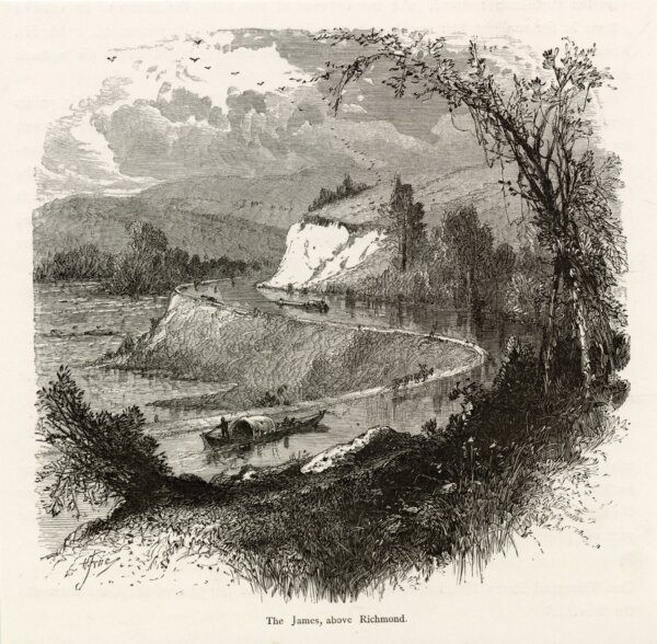
In the mid-1800s, batteaux were replaced by canalboats. With that, the history of the batteaumen largely vanished for more than a century.
“That changed in 1985, when several boats were discovered in downtown Richmond buried under the mud,” Smith said. “These boats sparked a resurgence and an interest in batteaux.”
The discovery of the vessels led to the first ever James River Batteau Festival later that same year. During the yearly event, groups build replica batteaux and pilot them 120 miles from Lynchburg to Richmond on a similar route as the batteaumen did 200 years ago. Hundreds of people in kayaks and canoes join on the eight-day journey with around 10 to 15 handmade batteaux.
In some spots along the river, including Scottsville, people crowd along the river when the group arrives and departs.
The festival is how Smith tipped his toe in batteau.
“My father built his first boat the year I was born in 1987,” he said. “I grew up coming down to the batteau festival and floating on the boat for a day.”
As teenagers, the Wills got involved in the festival. Smith captained his first boat in 2006, the year after he graduated from high school.
“We were the only ones on planet Earth floating down a batteau,” he said. “It was just about as unique as anything you could get involved with.”
After nearly 20 years of navigating the James, the men started giving batteau tours in 2022.
Connecting the dots in Va. history
The tour, Smith said, “connects the dots” between the role of tobacco and the settlement of the Piedmont for attendees.
Most people they come across don’t know much, if anything at all, about batteaumen. Some of that, Smith said, could be attributed to the sheer volume of Virginia history.
“I’m standing here in Scottsville, Virginia,” he said. “You drive 25 minutes up the road, Charlottesville, and there’s Monticello. Virginia, especially 17 to 1800s Virginia, just has a massive amount of history to cover.”
That’s the “generous” way to look at it, he said, but another explanation has more to do with the subjects of the stories.
“These being enslaved African Americans or freedmen of that time, we don’t have a lot of their stories that we end up celebrating as much in Virginia,” he said. “I think the fact that this was their story is one reason it’s been forgotten.”
That vision resonates with Virginians like the former mayor Gill, who was first exposed to batteaux upon moving to Scottsville in 1999 — but she said the tour gave her a more in-depth understanding of the James River’s role in Virginia’s settlement.
“It was a verbal history and almost a re-enactment of that history that brought the lessons home for me,” she said of the tour. “We really need to pay attention to our history, and what got us to where we are today. They tell that story about central Virginia so well.”
Get breaking news and daily headlines delivered to your email inbox by signing up here .
© 2024 WTOP. All Rights Reserved. This website is not intended for users located within the European Economic Area.

Jessica Kronzer graduated from James Madison University in May 2021 after studying media and politics. She enjoys covering politics, advocacy and compelling human-interest stories.
- @kronzer_news
Related News

Youngkin will visit Europe for his third international trade mission as Virginia governor

VDOT, FBI warn of new scam targeting toll road drivers

By July, all Virginia drivers will need to have vehicle insurance
Recommended.

Md. Board of Education picks Carey Wright as permanent public schools superintendent

At U.Md., they're making beautiful music faster — thanks to AI

DC man wanted in connection with Fort Totten shooting that left 5-year-old girl, father wounded
Related categories:.
- FANNATION FANNATION FANNATION
- SI.COM SI.COM SI.COM
- SI Swimsuit SI Swimsuit SI Swimsuit
- SI Sportsbook SI Sportsbook SI Sportsbook
- SI Tickets SI Tickets SI Tickets
- SI Showcase SI Showcase SI Showcase
- SI Resorts SI Resorts SI Resorts

History of NBA's No. 19 Pick as Raptors Learn Fate of Pacers' Selection
The Toronto Raptors will look to change history with the No. 19 pick and find one of the few stars taken late in the teens in this summer's NBA Draft
- Author: Aaron Rose
In this story:
No. 19 hasn’t been particularly kind in the NBA Draft.
This year will mark the first time the Toronto Raptors will pick at No. 19 after the Indiana Pacers came last in the league’s four-way tiebreaker to decide picks 16 through 19. Toronto will follow the Philadelphia 76ers, Los Angeles Lakers, and Orlando Magic, respectively.
This past year, Santa Clara’s Brandin Podziemski went at No. 19 and had an impressive rookie campaign for the Golden State Warriors. He started in 28 games this past season, averaging 9.2 points per game, and would be the kind of dream pickup Toronto would be looking for late in the teens.
Jake LaRavia, Kai Jones, Saddiq Bey, and Luka Samanic were all taken at No. 19 and have had varying degrees of success. Bey earned All-Rookie honors in 2020-21 as a member of the Detroit Pistons.
The Atlanta Hawks made back-to-back picks at No. 19, taking John Collins and Kevin Huerter in 2017 and 2018, respectively.
Tobias Harris and Zach Randolph are among the most successful players taken with the 19th pick in the last quarter century. Randolph was a two-time All-Star and one time All-NBA forward with the Memphis Grizzlies.
Canadian Jamaal Magloire was selected by the Charlotte Hornets with the 19th pick in the 2000 NBA Draft and spent one season with the Raptors before joining the organization as an assistant coach.
Toronto does have some experience drafting around the No. 19 pick, having taken Bruno Caboclo and Delon Wright at No. 20 in 2014 and 2015, respectively.
Latest Raptors News

Potential Crucial Loss Awaits Raptors in Matchup vs Pistons: Where to Watch, Injury Reports, and More

Grizzlies Do Raptors Favor With Crucial Victory

NBA Announces Fine After Nuggets vs. Raptors

Raptors Shorthanded as RJ Barrett Pops Up On Injury List

Injury-ridden Raptors Blow Second-largest Lead of 2023-24 in Loss to Nuggets
The islands of Louisville: How to visit and what to know about these Ohio River spots

The Ohio River is a relentless force, shaping and reshaping the landscape in its path.
Despite billions of gallons flowing by each day, persistent dredging and engineering of the waterway and the steady wake of recreational and commercial traffic, several riverine islands have stuck around near Louisville.
The islands on the Ohio River hold significant natural heritage and local history. And some are publicly accessible, offering recreational opportunities for boaters, paddlers and anglers.
Here’s what to know about the riverine islands closest to Louisville, starting upstream:
18 Mile Island
This island sits just downstream from Westport, carved out of the Kentucky bank of the Ohio in Oldham County. It's named for being roughly 18 miles upstream of Louisville, similar to 12 Mile Island and Six Mile Island.
Unlike most of the islands closer to Louisville, it's privately owned by Wood Island Inc., a business registered to Laura Lee Brown, according to state filings. Brown also co-owns nearby Woodland Farm and Hermitage Farm .
“Only disembark with permission from the farm manager,” says the Ohio River Way’s digital guide of the waterway .
18 Mile Island has a sandy beach facing Indiana, and a narrow channel separates it from the Kentucky shore. When it went up for sale along with the 900-acre Clifton Farm in the 1990s, a Courier Journal column described its allure to potential buyers:
“Marlon Brando owns an island in Tahiti. You could own an island, too, right here in the Ohio River.”
12 Mile Island
This island, also known as Embry Island, is split in the middle by the Jefferson-Oldham border and is publicly owned by Louisville Metro and Oldham County governments.
Camping is allowed on the island, according to the Ohio River Way guide, and “it gets crowded on weekend summer nights.”
It’s been a popular swimming, fishing and boating spot for decades, and there are wooden steps on the side of the island facing the Kentucky shoreline for access. The commercial marine highway runs on the Indiana side.
In 1992, The Courier Journal described ongoing local efforts to combat soil erosion on the island — and “the fear that the river will someday carry off their islands to Paducah” — including intentionally sinking barges on either end of the island to shield its banks, and planting trees and vegetation.
The island was also the setting of a Civil War clash in 1863 resulting in the capture of 20 Confederate soldiers, according to a recounting by Oldham County historian Nancy Stearns Theiss.
Six Mile Island
Six Mile Island is publicly owned and was established as a Kentucky nature preserve in 1979. It's open to the public during daylight hours, but overnight camping is prohibited.
It’s “noted for its variety of waterbirds,” according to the state , and “was protected so that it would be allowed to return to its original natural state.”
The island sits in a popular stretch of the river, downstream from Party Cove on the Indiana side and the mouth of Harrods Creek on the Kentucky side.
It was owned and farmed by the Ash family for about a century before it was purchased by Kentucky in the late 1900s. Goose Island once sat between Six Mile Island and the Kentucky shoreline, but vanished in the 1920s when the construction of the locks and dam downstream raised the river level.
Six Mile Island also marks the halfway point in the Great Steamboat Race, a long-standing annual tradition and part of the Kentucky Derby Festival. This year's race is May 1.
Recently, a proposed shipyard near Six Mile Island on the Indiana side of the river drew criticism from waterway and conservation advocates , who said the industrial development would endanger sensitive protected habitat on the island.
Some residents also provided public comment opposing the proposal, pointing to the island’s local recreational, cultural and environmental value.
Shippingport Island
Before the McAlpine Locks and Dam were built, the Falls of the Ohio marked the most treacherous stretch of the entire 981-mile river. The falls were a “series of rapids, waterfalls, and chutes,” dropping 26 feet over about 3 miles.
“When there was enough water, boats could attempt to run one of three chutes, or passages through the Falls,” according to the U.S. Army Corps of Engineers , “but this required expertise and boats often wrecked during the attempt.”
The Corps’ infrastructure at the falls now carries vessels through smoothly, from barges to kayaks, under the authority of the lockmaster. And the nearby hydroelectric dam, built nearly a century ago, helps generate more than 100 megawatts of power from the falls, according to LG&E and KU .
Shippingport Island acts as the fulcrum of the Corps’ civil works in the area. At one time, people lived on the island — The Courier Journal previously described “a bustling mix of wharfs, brick houses, taverns, an old mill (and) small farms.”
In the 19th century, "Big Jim Porter," an ostensibly 7-foot-8-inch-tall horse-drawn cab driver, "presided over several taverns in the wharf areas of Portland and Shippingport," according to a history of Portland published by The Courier Journal.
Flood risk eventually drove residents off Shippingport Island. Now, it’s a mix of industrial uses supporting the locks and dam and forested land, with a narrow head forming the entrance to the locks through the Louisville and Portland Canal.
The Corps restricts access to much of the island, but allows fishing along a beach on the western bank. It's accessible from 6 a.m. to 5 p.m. each day, across the bridge to the island and through a security gate.
Other Louisville islands
Past Shippingport Island and the locks, 5-acre Lewis and Clark Island was named to commemorate the start of the explorers’ expedition, which began at the Falls of the Ohio in 1803, according to the Louisville Historical League .
It neighbors Sand Island, a larger strip of land to the west also managed by the Corps. Both are popular fishing spots and are open to the public during daylight hours, accessible by boat.
High water and weather conditions, as well as discharges from the nearby locks and hydropower station, warrant caution for boaters. According to a Corps spokesperson, local fire departments and dive teams use the area for swift water rescue training.
And the nearby Falls of the Ohio State Park boasts 390-million-year-old Devonian fossil beds, among the largest of their kind in the world, and offers close access to the river without a boat. Nearly 300 species of birds have been observed near the falls and surrounding islands, which are designated as a national wildlife conservation area, and John James Audubon "studied and painted numerous birds at this spot," according to the Corps.
There's also Towhead Island just upstream of downtown Louisville, between Waterfront Park and Beargrass Creek. It's a thin strip of land typically lined with barges and owned by a company associated with nearby Nugent Sand Co.
And in the mouth of Beargrass Creek is a small dot of land, less than 200 feet from end to end. It’s nameless, but you can change that — the U.S. Geological Survey accepts name proposals for unnamed natural features .
Preserving the islands of the Ohio
The U.S. Fish and Wildlife Service established the Ohio River Islands National Wildlife Refuge more than 30 years ago to protect islands all along the Ohio, but most of the preserved land is along the West Virginia stretch of the river.
David Wicks, a local waterway advocate and educator, said the initiative ran out of steam, and no islands downstream of Maysville have joined the refuge. He hopes to see it renewed, to bring protections to more Ohio River islands.
“Louisville has some of the most concentrated area of islands” starting with 18 Mile Island, Wicks said on a paddle trip from Westport to Louisville last year. “The dream is to get U.S. Fish and Wildlife to get this, 12 Mile, Six Mile, Towhead, Shippingport, Sand Island, Lewis and Clark Island, all part of our wildlife management area for these migratory birds.”
Waterway advocates have also called for a National Water Trail designation for the Ohio River between Portsmouth, Ohio, and West Point, Kentucky — hoping to redefine the river as a recreational asset, not just a barge highway.
With more recreational value attached to the river, some local groups hope to bring economic momentum to river towns and protect the natural resources of the waterway in the process.
Connor Giffin is an environmental reporter for The Courier Journal and a corps member with Report for America, a national service program that places journalists in local newsrooms to report on under-covered issues. The program funds up to half of corps members’ salaries, but requires a portion also be raised through local community fundraising. To support local environmental reporting in Kentucky, tax-deductible donations can be made at courier-journal.com/RFA .
Learn more about RFA at reportforamerica.org . Reach Connor directly at [email protected] or on X @byconnorgiffin .

IMAGES
VIDEO
COMMENTS
The Riverboat is where the protest folk singing star Phil Ochs wrote his popular ballad "Changes.". When Eric Clapton was in Toronto with his band Cream, the Riverboat is where he went, with his hair tied in a bun as a disguise, to hear Tom Rush perform. When actor Jack Nicholson was in town shooting The Last Detail, he snuck in through the ...
The Riverboat. Coffeehouse in Toronto's Yorkville district. Seating about 100 in the narrow basement of a house at 134 Yorkville Ave, it was opened in October 1964 by Bernie Fiedler and became the best-known coffeehouse in Canada. Fiedler ran the Riverboat until 1977, by which time it was the sole remaining coffeehouse in the area.
May 3 - 8 Lynn Gold & Dwain. May 10 - 22 Jim and Jean. May 23 Gordon Lightfoot. May 24 - June 5 Tom Rush. June 7 - 19 Times Square 2. June 21 - 26 Eric Andersen. June 28 - July 17 Gordon Lightfoot. July 19 - 31 Marti Shannon & Folk Rock. Aug. 2 - 21 Sonny Terry & Brownie McGhee.
The Riverboat Coffee House was a Canadian coffeehouse located at 134 Yorkville Avenue in the Yorkville neighbourhood of Toronto, Ontario, Canada.It was a key venue for folk rock music and singer songwriter music made famous for featuring high-profile acts, and is considered to be "the best-known coffee house in Canada." It opened in October 1964 and closed on June 25, 1978.
Toronto Feature: Riverboat "A Subterranean Musical Oasis at the Riverboat" The most famous of all Yorkville's clubs, the Riverboat coffeehouse was a showcase for the biggest names in folk and blues music during the 1960s and 70s. Along with Odetta, James Taylor, Howlin' Wolf and Simon & Garfunkel, it provided a stage for Canadian artists, including Joni Mitchell and Neil Young, who later ...
History of Toronto's Waterfront Precincts ... The Ashbridges Bay Marsh was created by the lower Don River as it emptied into Toronto's inner harbour. The landscape in the area was dramatically altered in the late 19th and early 20th centuries. The Don River and the marsh it created posed many problems for the adjacent settlement of York and ...
The Riverboat and Yorkville's rich music history . ... When he returned to Toronto as a solo star in 1969, he performed for a week at the Riverboat-and later paid tribute to the club in his song "Ambulance Blues," in which he sang "back in those old folkie days, the Riverboat was rockin' in the rain." ...
The Riverboat. Coffeehouse in Toronto's Yorkville district. Seating about 100 in the narrow basement of a house at 134 Yorkville Ave, it was opened in October 1...
In the song, he immortalizes the Riverboat Coffee House, one of the world's best intimate venues for singer-songwriters during the hippie heydays of the 1960s. It was the longest operating coffee house of several dozen venues that lined Yorkville's cobblestone streets, north of Toronto's Bloor Street. In the 1960s, Yorkville was the Canadian ...
The Riverboat Coffee House opened in October, 1964 and quickly became part of a prestigious North American circuit that included Detroit's Chess Mate and New York's Bitter End. Situated below street level, the club seated 120 people in red booths amid pine walls and brass portholes. Every seat was in close proximity to the stage, providing ...
History Elevated portions of Toronto's waterfront, like the Scarborough Bluffs, made up the shorelines of Lake Iroquois, a glacial lake that preceded Lake Ontario.. Lake Ontario is a recent lake. As the last glaciation, the Laurentian glaciation receded, a number of proglacial lakes filled in basins adjacent to the glacier. One of those proglacial lakes was Lake Iroquois.
History Indigenous beginnings of the Don River Valley. The Don River and the surrounding Valley has a rich history in shaping and influencing Toronto's identity. Formed thousands of years ago by an ice age, the waterway became home to small groups of nomadic hunters. Human settlement can be traced back as far as 7,000 years ago.
Steamboats and Paddle Wheelers. Steamboat refers to the flat-bottomed, shallow-draft, steam-powered vessels, generally associated with inland navigation, as opposed to deep-keeled, oceangoing steamships. As invented in 1685 by French physicist Denis Papin, the paddle wheel (driven by compressed steam from wood- or coal-fired boilers) was ...
History Of the Port Lands. Two hundred years ago the area we now call the Port Lands was one of the largest freshwater marshes on Lake Ontario and home to many different species of wildlife. Ashbridges Bay Marsh, named after the Bay bordering its west side, was created by the lower Don River as it emptied into Toronto's inner harbour.
Toronto History. An overview of Toronto's History. An overview of Toronto's History. The French Colony (1615-1760) ... The "Toronto Passage" or "Toronto Carrying Place", following the Humber River, was an important overland shortcut between Lake Ontario and the upper Great Lakes. The region was populated by Indians of the Huron and ...
Map of Toronto and its rivers that make up "Toronto ravine system". The Toronto waterway system comprises a series of natural and man-made watercourses in the Canadian city of Toronto.The city is dominated by a large river system spanning most of the city including the Don River, Etobicoke Creek, Highland Creek, Humber River, Mimico Creek and Rouge River.
Date Concert Venue; Location May 05, 1968 Joni Mitchell: The Riverboat: Toronto, Ontario, Canada: Joni Mitchell: The Riverboat: Toronto, Ontario, Canada
History of Riverside. Riverside runs alongside the Don River - an icon in Toronto's landscape and history. The name 'Riverside' dates back to the 1880s. As you wander Queen Street East in the heart of Riverside, note the curving blue brick 'river' in the sidewalks and the public art referencing that connection throughout. The ...
The name of Toronto has a history distinct from that of the city itself. Originally, the term "Taronto" referred to a channel of water between Lake Simcoe and Lake Couchiching, but in time the name passed southward, and was eventually applied to a new fort at the mouth of the Humber River. Fort Toronto was the first settlement in the area ...
In 1966, the energetic Lena started working again, operating a 50 boat marina in Marie Curtis Park at the mouth of Etobicoke Creek. Bill passed away in 1958 at the age of 83. The Toronto Humber Yacht Club after they had built an addition with a new entrance on the south side of the former boat house, ca.1956.
Toronto was originally used on maps dating to the late 17th and early 18th century to refer to Lake Simcoe and the portage route to it. Eventually, the name was brought down to the mouth of the Humber River, which is where the present City of Toronto is situated.The bay serves as the end of the Toronto Carrying-Place Trail portage route from Lake Simcoe and Georgian Bay.
By LIAM MAYO. BETHEL, NY — After 20 years of struggle, the Toronto Reservoir access remains open to the public. The Friends of the Toronto Reservoir (FOTR) held its 20th anniversary celebration on August 24, celebrating the success of that struggle and that the reservoir remains open. The reservoir is one of five in the Mongaup River system.
Peel Regional Police said Wednesday that 6,600 gold bars worth more than 20 million Canadian dollars ($14.5 million) were stolen, the biggest gold theft in Canadian history.
As of May 2023 Hot Docs, according to Canada Revenue Agency report, had a $1.5 million deficit. Fishkin and Nelson, are asking for personal donations to keep their respective festivals standing ...
The James River Batteau Company in Scottsville, Virginia, shares the history of the boat that helped establish colonial Virginia — and the men who piloted the vessels in the 18th century.
The Don River is a watercourse in southern Ontario that empties into Lake Ontario, at Toronto Harbour.Its mouth was just east of the street grid of the town of York, Upper Canada, the municipality that evolved into Toronto, Ontario.The Don is one of the major watercourses draining Toronto (along with the Humber, and Rouge Rivers) that have headwaters in the Oak Ridges Moraine.
The Toronto Raptors will look to change history with the No. 19 pick and find one of the few stars taken late in the teens in this summer's NBA Draft. Author: Aaron Rose. Apr 23, 2024.
Past Shippingport Island and the locks, 5-acre Lewis and Clark Island was named to commemorate the start of the explorers' expedition, which began at the Falls of the Ohio in 1803, according to ...